Location: Cordova, Alaska
At the end of the last blog, we were in Hoonah preparing for our voyage up the coast of the Gulf of Alaska to Prince William Sound, where we plan to spend most of the summer. We arrived in Cordova on Thursday morning and will be here for a few days exploring the town.
 |
The Hubbard Glacier.
|
June 2, Sunday, Hoonah: Dave did some maintenance on the shaft seal
while I did laundry. We updated the
maintenance log and our monthly budget, transferred fuel and switched over to the
starboard anchor. For our afternoon
adventure, we walked along the shore to Icy Strait Point, where the cruise ships dock
in Hoonah. There is an old cannery that
has been restored and converted into a museum and shops, a beach walk, a nature
trail and adventure park, three restaurants, several outdoor fire pits and a zip-line ride. We had a beer at the bar and watched people
coming down the zip-line, billed as the one of the longest in the world with speeds up to
60 miles per hour.
 |
| Folks coming down the Hoonah Zip Rider (see the Icy Strait Point web link above for better pictures and a full description). |
 |
A traditional, hand carved Tlinglit dugout canoe at the Hoonah Harbor transient dock, waiting for their guests to arrive.
A paddle around the bay in the canoe is an adventure/cultural experience available in Hoonah. |
June 3, Monday,
Hoonah: This morning Dave worked on
replacing the belt on our after-market alternator. It has been squealing and producing a lot of
belt dust. On our voyage into
Hoonah, we weren’t getting the charging amperage into our batteries that we
usually get if both alternators are working.
Andy, the Hoonah Harbormaster, came down to the boat for a visit. We had lunch at the Fisherman’s Daughter,
then walked up to the post office to mail a package. It rained most of the afternoon so we read
our books and did some voyage planning.
 |
| The Hoonah Carver's Den. |
 |
| A close up view of the totem pole being carved in the Hoonah Carver's Den. |
June 4, Tuesday, Hoonah to
Dundas Bay (44 nm, 7 hours): I went for
a walk this morning and then we cast off the lines and pulled away from the
dock about 9:15. We stopped at the fuel
dock to get gas for the dinghy then headed across Icy Strait to Dundas Bay. Dundas Bay is part of Glacier Bay National
Park. It is located west of the main bay and no permit is required. As we entered the narrow part of the bay, we
spotted two moose and then two bears on the east shore. We saw a brown bear in a patch of grass on a
small island on the west side of the channel and lots of sea otters with
pups. We wound our way up the channel
and anchored at the far end of the northwest arm.
 |
| Sea lions hauled out on the rocks on the west side of the Inian Islands. |
June 5, Wednesday, Dundas
Bay to Elfin Cove (19 nm, 3 hours):
Anchor up at 7:30 this morning and we headed out of Dundas Bay towards Elfin
Cove. In addition to lots of sea otters, we saw the same bear that we saw yesterday on the small island, then a bear turning over rocks and a moose on the
western shore. We cruised down the west
side of the Inian Islands and arrived in Elfin Cove about 10:30. There was no room at the outer dock, but a
fishing troller was getting ready to leave so we hovered until they pulled
out. A couple on a sailboat
from New Zealand was at the dock getting ready to leave. They had spent some time cruising in Japan so
we picked their brains and got their blog information before they pulled away. We went for a walk up the boardwalk, stopped for lunch at a small bar and grill and then walked to the head of the bay and back around to the fuel
dock where we stopped and chatted with Dave from MV David Ellis. He and his wife
Dorothy used to participate on the morning HAM net. They are in Elfin Cove for 18 months where
she is the post mistress and he is operating the fuel dock. The sun was out when we got back to the boat,
so Dave suited up in his dive gear and went into the water to check the aluminum anodes. All looked good with the anodes
but he did find some damage on our port side stabilizer fin which must have
been from the rock we hit earlier this spring.
 |
Underwater shot looking up at the bottom of the port stabilizer fin.
The top right shows the chunk of fiberglass that is missing. |
Around supper time, Wayne, a local guy with a cabin near the playground,
came down and invited us to supper at his place. Four guys from a fishing
troller out of Gustavus, plus the guy who runs the power station
in Elfin Cove were also there. Supper was steak, potatoes and corn-on-the-cob, all delicious and a nice treat. We heard some great stories about fishing and hunting in the area and picked up
some local knowledge about Lituya Bay and Yakutat.
 |
| Arch, George Islands, Cross Sound |
June 6, Thursday, Elfin
Cove to Lituya Bay (55 nm, 8 hours): Our
plan was to leave the dock between 8:00 and 8:30 this morning in order to catch
the flood tide at the entrance to Lituya Bay.
The entrance channel is very narrow, about 50 yards wide, with rocks and
shoals on both sides and currents that run up to 6 knots. As the coast pilot states “the entrance is
dangerous and should never be attempted except at slack water because of the
strong current.” About 7:30, +/- 25
people from the various lodges in Elfin Cove gathered on the float plane dock
just astern of us, waiting for the float planes to come in and take them home
after a week of sport fishing. They were
a pretty lively crowd. We were afraid that we were going to be boxed in and wouldn't be able to leave on schedule but at 8:00, three float
planes landed, loaded up everyone and their gear and flew out. We got away from the dock ~8:20 and headed
west out of Cross Sound and into the Gulf of Alaska.
 |
| Cape Spencer Light House as we exited Cross Sound and entered the Gulf of Alaska |
We rounded Cape Spencer at
the northwest side of Cross Sound and turned northwest up the coast. We had winds from the west north west at ~15
knots and swell from the southwest with waves 3 – 4 feet. We did some pitching but overall not too bad. It was partly cloudy but we could see the
peaks of the Fairweather Range and the glaciers along the coast. About 24 miles north of Cape Spencer is La
Perouse Glacier, named after the first European explorer to document his
travels into Lituya Bay. From the Coast
Pilot “La Perouse Glacier … is an outstanding landmark along this coast … The
face of the glacier is 200 to 300 feet high and is nearly perpendicular; at the
foot of the glacier is a narrow strip of sand beach strewn with boulders.”
 |
| La Perouse Glacier |
We reached the entrance of
Lituya Bay at 15:30.
The flood current
was running about 3.5 knots and we could see the currents swirling inside the
entrance.
A set of range markers is in
place on the shoreline opposite the entrance to help you line up mid-channel as
you enter the bay.
We lined up and came
through with no issues.
There was a
small motor boat anchored near the shore to the north of the entrance, a large
power boat anchored to the south near the Paps and a sail boat followed us
through the entrance.
We made our way to
the east side of Cenotaph Island, dropped off the crab trap and anchored in a
small cove near the island shore.
 |
| The Fairweather Mountain Range |
The spit on the north side
of the Lituya Bay entrance is named La Chaussee (The Chopper): “The French could not have
found a more suitable name for this spit.
The large boulders along its seaward side, combined with the demolishing
effect of heavy swells breaking, ensure that anything caught on the bar in
heavy weather will quickly be reduced to rubble.” (Quote from Land of the Ocean
Mists by Francis E. Caldwell). Lituya Bay is best known for the giant wave that occurred in July 1958, as described in the Coast Pilot: "In July 1958, a giant wave, caused by an earthquake-induced avalanche, denuded the shores of Lituya Bay of trees to a height of 1720 feet. Giant waves are a recurring phenomen in the bay, and other catastrophic waves were observed in 1853, 1874 and 1936. Steep shattered cliffs at the head of the bay present a continuing hazard of avalanches; destructive waves, caused by rock falls, can occur at any time."
 |
| A view from our stern of the Fairweather Mountains at the head of Lituya Bay |
 |
| The Fairweather Mountain Range and Cascade Glacier at the head of Lituya Bay |
June 7, Friday, Lituya
Bay: We motored up to
the head of the bay this morning to look at the three glaciers there – Cascade Glacier,
North Crillon Glacier and Lituya Glacier.
All have receded back from the shoreline and most of the ice is covered
with dirt and debris. North Crillon and
Lituya both have rivers flowing out of them and the water at the head of the
bay is milky blue/gray. We saw a black
bear on the shoreline near North Crillon Glacier but he ran into the woods when
he heard us coming. There is an elusive subspecies of black bear in the Lituya Bay area called the glacier bear which
has blue/black fur. We were too far away to get a good enough look to confirm
if the bear was a regular black bear or a glacier bear.
Nesting kittiwakes on the south shore of Cenotaph Island, Lituya Bay
By the time we finished our sight-seeing tour, the other boats had exited the bay so we anchored near the Paps, closer to the entrance. For our afternoon
adventure, we launched the dinghy and went to the beach at the north end
of La Chaussee spit to do some exploring.
There were fresh grizzly bear tracks in the sand along the beach that
made the hair on the backs of our necks stand up. We had our bear spray with us and made lots
of noise, singing and talking, while we were ashore.
 |
| Bear scat on the beach, Lituya Bay. |
June 8, Saturday, Lituya to
Yakutat (97 nm, 13 hours): A long day
today. We exited Lituya Bay at 5:00 in
order to catch the flood tide near slack water and turned northwest up the
coast. It was overcast, 50F/10C, with
light winds and less than 2 feet seas - a nice day to be out on the ocean. We saw two humpback whales feeding near shore
just outside of Lituya Bay and an orca just north of Cape Fairweather. As we neared Dry Bay, where the Alsek River
drains into the Pacific, the water turned glacial blue/green and we spotted
some huge trees floating 6+ miles offshore.
 |
| Dave working on his pump skid on the voyage from Lituya Bay to Yakutat |
 |
| Two trees joined at the roots floating 6+ miles offshore of the Alsek River mouth |
We came around Ocean Cape,
entered Yakutat Bay about 17:30 and called the harbormaster on the VHF.
He wasn’t at the docks but told us we might
have to raft up or if we couldn’t find space, we could tie up to the float
plane dock for the night, which is what we did.
We settled in for the night:
happy hour, supper, reading and bed.
June 9, Sunday,
Yakutat: We moved off the float plane
dock this morning and tied up alongside the dock in an open space which is
usually occupied by a local fisherman.
His brother, Jonathon, stopped by, helped us tie up and asked how long
we were going to stay. Gill net season
opened this morning at 6:00 so there was a lot of activity in the harbor with
boats going out and coming back in. We
walked into town and checked out the two grocery stores and the historical
railroad exhibit of the Yakutat and Southern Railroad, the only train system of its time built to serve the fishing industry.
 |
| The Yakutat and Southern Railroad Exhibit in Yakutat |
It was a bright sunny
day so after our walk we set up to wash the boat.
Jonathon stopped by to let us know his brother would be back in Tuesday
or Wednesday. We talked about Lituya
Bay; he had never been there but his brother had, so we gave him our Lituya
Bay book “Land of the Ocean Mists”. He
asked if we needed any fish then offered us a 25 pound king salmon that he had
caught earlier today. He told us that
they don’t catch enough of king salmon this time of year to sell commercially so he
usually gives them away. Dave filleted the fish, we gave some to the tug boat captain who was docked at the transient dock, saved two fillets for supper and vacuum-packed the rest.
 |
| 25 pound King Salmon on the stern deck |
 |
| B in the galley preparing to vacuum pack the salmon fillets. |
June 10, Monday,
Yakutat: The tug boat moved out from the
corner of the transient dock this morning, so we moved into that slot. The harbormaster stopped by for a coffee and
a visit, then we finished our boat washing project. After lunch we walked into town. Dave got a haircut while I picked up a few
groceries then we had a beer at The Glass Door, the local bar, and did some
internet stuff.
 |
| A view of the mountains on the north side of Yakutat Bay |
June 11, Tuesday,
Yakutat: Heavy rain this morning so we
hung around the boat and did boat chores.
Watched a sailboat come into the dock early evening. They had been out at sea trying to cross the
Gulf of Alaska to Seward when the weather picked up. They made a course change and came into
Yakutat to get out of the weather.
June 12, Wednesday,
Yakutat: Rain again today and more boat
chores. We have had two
hummingbirds at the feeder on the stern so I filled another feeder and hung it on
the boat deck where we could watch it from the pilot house. It didn’t take them long to discover the new
food source and we enjoyed watching them coming and going. The fish cutting table at the docks was
located directly astern from us and we watched four sport fishermen bring in
some big halibut. The largest was 68”
long and weighed ~200 pounds.
 |
| View from our stern of four sport fishermen cleaning their catch at the fishing cleaning station in the Yakutat Harbor. |
 |
| A huge halibut, 68" long, ~200 pounds. They brought in four halibut, the big one and three the size of the smaller one in this photo, plus two rock fish. |
June 13, Thursday, Yakutat
– Hubbard Glacier/Russell Fiord (~60 nm round trip on a local charter boat): It was sunny out today so we did some outside
chores then walked into town to the grocery store and the hardware store. About 17:00 we boarded a local charter boat
and headed up the bay to the Hubbard Glacier, nicknamed "The Galloping Glacier" because of its history of periods of rapid advancement into Disenchantment Bay. The Hubbard Glacier is the largest tidewater glacier in North America; it is 76 miles long, the face of the glacier where it meets the water line extends ~6 miles and is up to 400 feet tall and the ice at the bottom of the glacier is 400+ years old.
 |
| Approaching the face of Hubbard Glacier where it meets the sea in Disenchantment Bay. |
Cruising through the ice field toward the face of Hubbard Glacier.
The "thunks" you can hear are ice chunks hitting the hull of the boat.
The skies were mostly clear and we had a good view of the mountains to
the west, including Mount St. Elias. We entered Disenchantment Bay and the ice
field coming off the glaciers then stopped at the high cliffs on the west side
of Haenke Island to look at the Kittiwake nesting area there.
 |
| Birds perched on bergie bits near Haenke Island |
 |
| Kittiwakes nesting on the steep cliffs of Haenke Island |
 |
| Iceberg near Haenke Island |
Through more ice and up close to the face of
Hubbard glacier where we watched as it calved and huge pieces of ice dropped
into the water below.
 |
| A point on the face of Hubbard Glacier where it meets the sea in Disenchantment Bay. |
 |
| The face of Hubbard Glacier in the Russell Fiord Narrows. |
Hubbard Glacier face.
Along with Mark, the captain, and his wife, there were three other passengers on board the boat, scientists who had studied the surging of the Variegated Glacier in 1982 - 1983. They were going out to camp and hike near Variegated Glacier with the goal of taking a photo in the same spot where they had taken a group photo 36 years ago. We went through
the narrows into Russell Fiord, past the south end of Hubbard Glacier and then
the scientists scanned the beach to see where they wanted to be dropped off to
begin their hiking trip.
 |
| Ice bergs grounded in the shallow area of Russell Fiord Narrows. |
They chose a
spot to the south of two river mouths.
We anchored the boat just offshore then launched a small dinghy.
One by one, they rowed themselves and their
gear ashore with Mark using a fishing rod to bring the dinghy back to the
boat.
Once they were all safely ashore,
we loaded the dinghy back onto the boat, waved goodbye and headed back out the narrows.
 |
Herman rowing himself and his pack to shore; the other two scientists, Mindy and LeeLee, are on shore waiting for him.
|
 |
Waving goodbye to the three scientists as Mark reels the dinghy back to the boat.
The Variegated Glacier is in the background, upper left. |
We spent some more time near the face of the
glacier watching it calve then headed back down the bay to Yakutat.
 |
| Dave and B on the stern of the boat with Hubbard Glacier in the background. |
 |
| Splash of water as a large chunk of ice slides off the face of the glacier |
 |
| The wake of the boat as we leave Hubbard Glacier and head back to Yakutat. |
June 14, Friday, Yakutat: Another nice sunny day. We spent the morning doing maintenance and
chores and watching the sports fishing activities in the harbor. After lunch we walked into town and stopped
at the usual places: grocery store,
hardware store, book exchange, bar and liquor store. We spent some time on the internet then
walked back to the boat for supper. We
prepared for an early departure in the morning then called it a day.
June 15, Saturday, Yakutat
to Icy Bay (66 nm, 8.2 hours): We left
Yakutat Harbor this morning at 7:15. We
worked our way out of the bay, past the sport fishermen fishing near the mouth
of the bay, and headed west towards Icy Bay.
An uneventful voyage: overcast
skies, winds 15 – 20 knots and seas of 3 - 4 feet. We turned into Icy Bay about 15:00 and it was
immediately obvious that it was appropriately named. The whole north west side of the bay was full
of ice chunks and bergie bits. We came
around Point Riou Spit and Moraine Island and anchored across from the
lodge. The tug boat crew that we met in
Yakutat are working up there pushing logs around for the timber industry and
they greeted us on the VHF when we pulled in.
 |
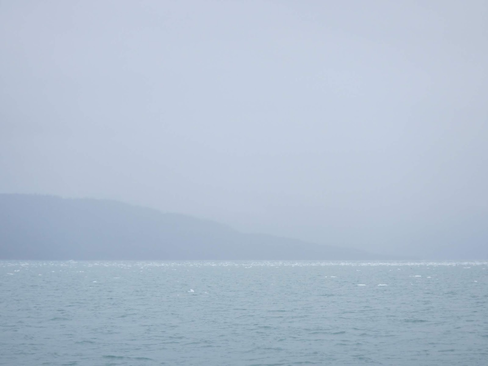
| Entering Icy Bay. Although difficult to see in the fog, the north shore of the bay is filled with ice chunks. |
June 16, Sunday, Icy Bay to
Kayak Island (113 miles, 14 hours): We
left the Icy Bay anchorage at 4:30 and headed west across the Gulf of Alaska
towards Kayak Island. It was a long,
straight course, 98 nm, from the mouth of Icy Bay to Cape St. Elias at the
south end of Kayak Island. Overcast
skies, wind up and down 15 – 30 knots and seas 5 - 6 feet. We saw a few whales and a small group of Dall’s porpoises
along with some shearwaters gliding across the top of the waves but other than
that a quiet voyage. About 17:00, we turned north and headed up the west side
of Kayak Island. There were winds +30 knots coming over the top of the island
generating some wind chop but we were protected from the ocean swell. There were hundreds of birds, two small pods
of whales and sea lions feeding along the shorelines of Kayak and Wingham
Islands. At 18:30, we dropped anchor in
a small sheltered bite on the west side of Kayak Island and to the south of
Wingham Island, ~10 nm north of Cape St. Elias, and settled in for the night.
 |
| Kayak Island and Pinnacle Rock as we approach from the east. |
June 17, Monday, Kayak
Island to Garden Cove (79 miles, 11 hours):
The wind blew and it rained most of the night and it was still windy and
rainy when we got up. In order to catch
the flood tide going into Hitchinbrook Entrance at the end of our voyage today,
we scheduled a 12:30 departure from the anchorage. We spent the morning doing projects and
chores, had lunch and then got underway.
By the time we left, the rain had quit and the wind had slacked off
some. It was a 68 mile straight line
course from the anchorage to Cape Hitchinbrook.
We saw two orcas and a humpback along the way but other than that a
quiet, uneventful voyage. We came around
Cape Hitchinbrook at 22:15, turned east into Port Etches Inlet and worked our
way up to Garden Cove. We were anchored
up by 23:30, just after sunset.
 |
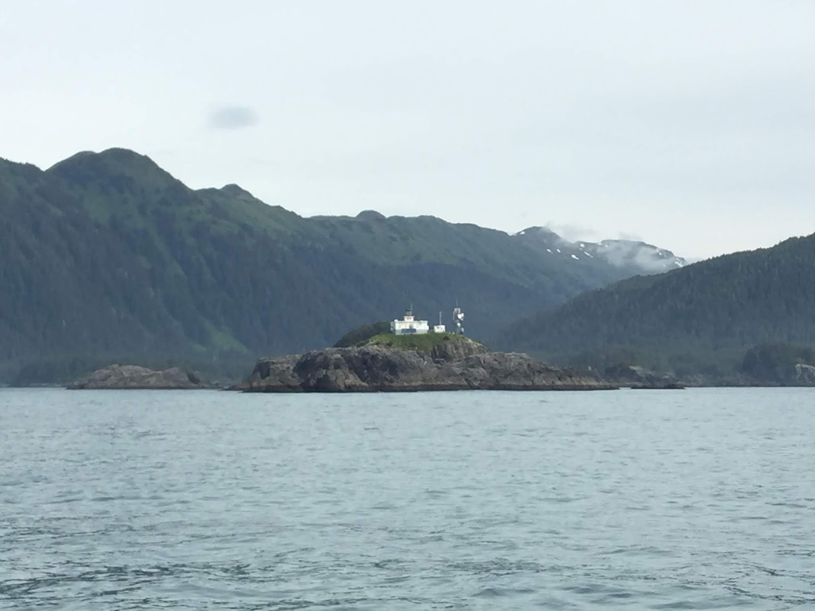
| The sun peeking out of the clouds as we approach Cape Hitchinbrook. |
 |
| The Cape Hitchinbrook lighthouse. |
June 18, Tuesday, Garden
Cove to Constantine Harbor (3 miles, 45 minutes): We had a nice quiet night at anchor and the
sun was out when we got up this morning.
We watched a sea otter and her pup swimming around the cove. It looked like she was giving the pup
swimming lessons as he rolled and turned and swam forward and backward while
she dove for clams.
 |
| Small islands near the entrance to Garden Cove. On the left side of the photo is an oil response barge. |
We heaved anchor at
14:30 and cruised across Port Etches to Constantine Harbor. There is a shallow bar at the entrance to the harbor that can only be crossed near high tide.
We entered with no issues, the minimum depth of water we saw under the keel was 5 feet, anchored up and scanned the shore line for bears and deer. We spotted a doe and a fawn on the beach and
the harbor was full of sea otters, some very curious about the boat and “spy-hopping”
to get a better look.
June 19, Wednesday,
Constantine Harbor to Windy Bay (37 miles, 5 hours): This morning we went for a paddle in our
kayaks. We were able to get very close,
within 40 feet, to a large raft of sea otters.
Sea otters in Constantine Harbor
We watched the sea otters for a while
then paddled counter-clockwise around the harbor and back to the boat.
 |
| Dave paddling near the north shore of Constantine Harbor. |
 |
| Seabiscuit at anchor, Constantine Harbor |
We heaved anchor at 13:45, after the tide was
over 5 feet, then made our way out of the harbor, into Port Etches and up into
Prince William Sound.
 |
Porpoise Rocks on the north side of the entrance to Port Etches Inlet.
They were filled with birds, gulls, puffins, cormorants, etc. |
Once we got around
to the north side of Hitchinbrook Island, it was like cruising on a mill pond –
no swell, no wind and no waves.
We saw
two orca and some humpback whales and there were a lot of fishing boats on the
move.
We turned into Windy Bay and
anchored up in a small cove near the west shore.
 |
| Entering Windy Bay on the north coast of Hawkins Island. |
June 20, Thursday, Windy
Bay to Cordova (12 miles, 2 hours): We
left Windy Bay this morning and headed down Western Channel to Cordova. We tied up at the transient dock in the small
boat harbor and went into town for lunch.
Cordova is a fishing community; the harbor is full of all types of
fishing boats and there is a lot of activity.
We will spend a few days here exploring the town and doing some voyage
planning for the rest of the summer.
 |
Bald eagle on the dock in Cordova Harbor.
A seagull dropped a piece of fish nearby and the eagle is waiting for us to walk by before he moves over to pick it up. |
Until next time…