Location: San Diego, California
Since the last blog, we left Port Angeles,WA; exited the Strait of Juan de Fuca and cruised down the west coast of Washington, Oregon and California to San Diego Bay, a total of 1330 nm. We'll be in San Diego until November 1st when we head south to Mexico with the 2021 Baja HaHa Cruisers Rally.
 |
Sunrise over downtown San Diego
|
Wednesday, August 4, 2021 – Port Angeles, WA to Neah Bay,
WA (52 nm, 7.3 hours): We took up the trash, rinsed the salt off the pilot house windows and left the dock in Port Angeles ~8:30. We had good visibility, the wind was blowing 15 - 20 knots from the west and we had some wind waves as we traveled west down the Strait of Juan de Fuca. We ran into some fog and turned on the radar for a while. We anchored up in Neah Bay ~15:45 and settled in for the night.
 |
| Entering Neah Bay, WA |
Thursday, August 5, 2021 – Neah Bay, WA to Grays Harbor,
WA (111 nm, 14 hours): We got up at 4:00 this morning and heaved anchor at 4:30. The wind in the anchorage blew 15 - 20 knots all night but it wasn't bad out in the Strait. We turned south after rounding Cape Flattery, entered the Pacific Ocean and started our journey down the coast. From here, all of the stops along the Washington and Oregon coast require a bar crossing. The National Weather Service publishes local bar observations that mariners use to determine whether or not it is safe to enter or exit a harbor across the bar. We consulted the bar observations each morning before we departed and planned our voyage start and end times in accordance with the flood and ebb tides across the bars.
It was foggy most of the day. There was about 0.5 knots of ocean current setting south and we made better time than anticipated so we were a little early to cross the bar into Grays Harbor. We motored down to the south entrance to kill some time, then entered the harbor ~18:15 and made our way into the harbor.
 |
| Entering Grays Harbor in the fog |
We tied up on the tee head of Dock 10, across the alleyway from the bait fish pens and a popular area for the seagulls. The dock was covered in bird poop and we made sure to leave our shoes outside the door before coming inside. We walked up to a local bar and grill and had hamburgers for supper.
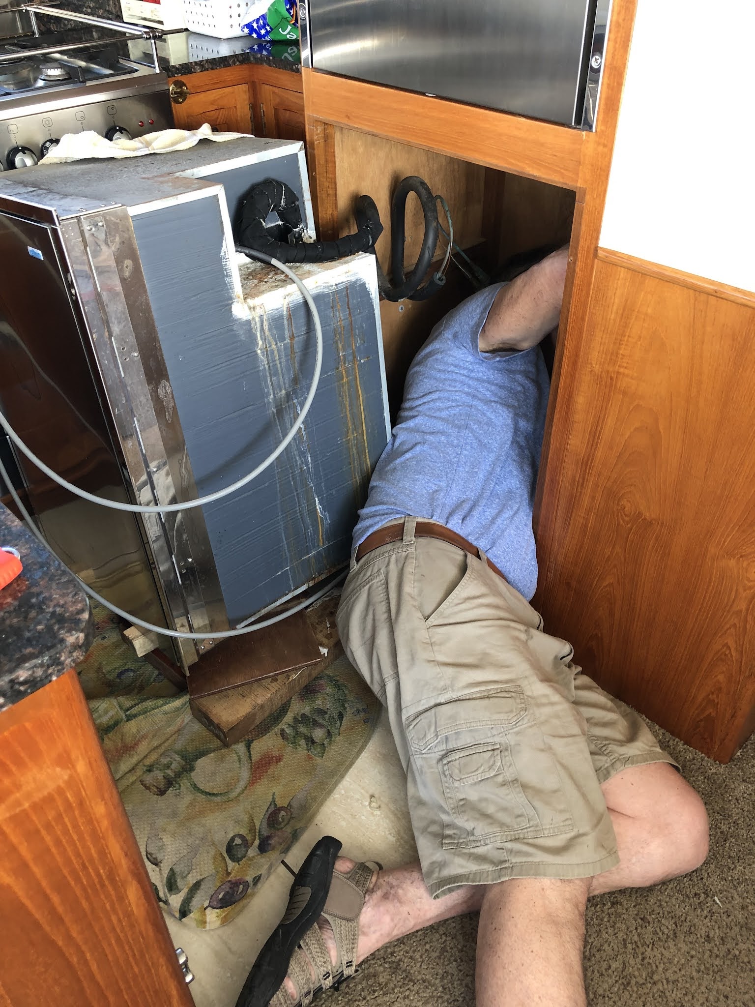
Friday was a beautiful, sunny day which was a pleasant surprise. For our morning adventure, we walked the Westport Light Beach trail south along the shoreline then east past the old lighthouse and into the town of Westport for lunch and a stop at the marine store. We bought electrical wire for our freezer project and spent the afternoon pulling out the old wire and installing the new wire.
 |
| The Westport lighthouse |
 |
| Dave working on the freezer |
Saturday, August 7, 2021 – Grays Harbor, WA to Garibaldi,
OR (90 nm, 12 hours): We left the dock at 8:30 this morning in the rain and the fog. It was 58F/14C and the wind was blowing 10 - 15 knots from the south. There was no drama exiting across the bar and we continued our journey south. We crossed the mouth of the Columbia River about 14:00, near slack water. It was busy with marine traffic and we could see lots of activity on the radar and via AIS and hear the VHF radio conversations of the pilots and the ships making plans to enter and exit the river. The US Coast Guard made announcements on the VHF at regular intervals reminding boaters of Navigation Rule 9 which says, among other things, that in narrow channels, small vessels shall not impede the passage of large vessels that can safely navigate only within a narrow channel or fairway - in other words, stay out of the way. The Columbia River bar crossing can be extremely dangerous but today at ebb slack, except for the reduced visibility, all was calm.
 |
| Cruising south in the rain and the fog |
As we continued south, we studied the bar crossing for Tillamook Bay / Garibaldi and found it confusing. The chart showed the entrance to the channel was from the NNW; the Coast Pilot write-up said the entrance was from the south, but a user comment said it was outdated and the new entrance was from the NNW. A pamphlet we found on-line published by the Oregon government showed a diagram with the entrance from the south. We finally called the Tillamook Coast Guard station to get clarification. They informed us that the entrance was from the NNW as indicated on the updated charts. Visibility improved as we neared the entrance and we could see the buoys marking the channel. We crossed the bar about 19:30, 30 minutes before slack water with no drama and made our way up river to the Port of Garibaldi. There was no space available at the guest dock or the end ties so we tied up to the fish processing dock for the night.
Sunday, August 8, 2021 – Garibaldi, OR to Newport, OR (72
nm, 10 hours): We had originally planned to stay in Garibardi for a few days, but since there wasn't room at the docks and the weather was good we continued south. When we crossed the bar out of Tillamook Bay, the entrance was restricted for vessels less than 26 feet. A lot of small sport fishing boats were hovering inside the entrance waiting to go out and, once the current changed from ebb to slack, the Coast Guard lifted the restriction and the fishermen got to go fishing.
We cruised about 5 nm offshore for most of the day. We had good visibility which was a nice change from the fog. We saw a whale and 5 ocean sunfish, also called Mola Mola, which are said to be rare along the Oregon coast. We arrived at the Yaquina Sea buoy close to max ebb so we cruised offshore to waste some time before crossing the bar and making our way to the guest dock in the Port of Newport. We secured our lines and walked over to the Rogue Brewery for beer and supper.
 |
| The bridge across the Yaquina River, Newport, OR |
 |
| Entrance to the Rogue Brewery, Newport, OR |
 |
| Beer tasting at the Rogue Brewery, Newport, OR |
We spent the week doing boat chores, walking the shoreline and Yaquina Bay estuary and exploring the town of Newport. .
Friday thru Sunday, August 13 - 15, 2021 – Newport, OR to
Bodega Bay, CA (411 nm, 53 hours): The weather looked good to continue down the coast on Friday morning. We left the dock at 9:30 in order to cross the bar after ebb slack. The conditions offshore were good - a long, low swell, no wind wave, light winds less than 10 knots, 57F/14C. It was hazy so we used the radar for the first two hours then turned it off after the haze cleared. Our plan was to do an overnight cruise from Newport, OR to Crescent City, CA ~185 nm. Late Friday evening the weather still looked good and we decided to go ahead and do two overnights to get south of Cape Mendocino while the weather was in our favor. During the day, we took turns at the helm doing 1 - 1.5 hours watches. For the overnights, we did 4 hour watches with Dave taking the 20:00 - midnight, me taking the midnight - 4:00, and Dave taking 4:00 - 8:00.
The afternoon of the second day (Saturday), as we neared Eureka, CA, I had some second thoughts about continuing for another night mainly because of the ports south of Eureka. The first port south of Cape Mendocino would be Fort Bragg / Noyo River. Based on our timing, we would arrive there ~2:00 a.m. and would either have to enter in the dark or wait offshore for first light. The next port south was Bodega Bay. If we continued, we would arrive there early afternoon on Sunday. We checked the weather, and although it wasn't as nice as it had been, it still looked good to go around Cape Mendocino. We decided to continue with Bodega Bay as our destination.
The wind picked up as we came around Cape Mendocino blowing from the north 15 - 20 knots with gusts up to 30+ knots, generating 6 feet SIG waves. SIG waves (the link here provides a technical description and formula for SIG waves) as defined on Wikipedia means "significant wave height ...is defined traditionally as the mean wave height (trough to crest) of the highest third of the waves". The swell was from the southwest and we had mostly following seas. We did a lot of rolling and things that weren't tied down or secured crashed and rolled around. While Dave was on the 20:00 to 0:00 watch, the bilge alarm in the mid-ship hold went off. We checked it; nothing was leaking, it was all condensation created from temperature differential between the cold ocean and the warm boat interior. We had talked about vacuuming it out before we left Newport, but it was a chore we didn't get to.
By the time I came on watch at midnight, the winds had died down but the seas were still up. There was very little marine traffic and the only thing on the radar was an offshore weather buoy. Friday night was foggy, but tonight (Saturday) the skies were clear and we could see the bright 1/4 moon, the stars and the lights along the coast. Another shift change at 4:00 and Dave watched the sun come up as we came around Point Arena 30 nm south of Fort Bragg.
 |
| Watching the Sunday morning sunrise, underway from Newport, OR to Bodega Bay, CA |
The wind was supposed to pick up again south of Point Arena but it didn't and the seas settled down some. We turned into the Bodega Bay entrance channel ~14:30 and tied up to an end tie at
Spud Point Marina. For supper we walked up to the
Spud Point Crab Company for clam chowder and crab sandwiches.
We decided to stay in Bodega Bay until Friday morning to let some weather move through before making the run to the San Franciscio Bay Area. Monday morning we made a list of the things we wanted to do while we were here. First on the list was to vacuum the condensate out of the bilges.
Late Monday afternoon, we walked south along the coast, then hiked up the Westside Trail to the top of the dunes and north along the dunes ridgeline on the Upper Dunes Trail. We planned to walk the trail until it looped back towards the marina, but we took a wrong turn and had to bushwhack our way down the dunes, then south along a marsh and back to the trail head where we started. A good walk and we both needed the exercise. Back to the boat for supper and we watched the movie One Night in Miami which we enjoyed.
Tuesday was chore day. I've probably mentioned in previous blogs that we have been having issues with our depth sounder. Dave found someone in Santa Cruz who walked us through some troubleshooting over the phone. None of the fixes worked so we scheduled an in person visit with him once we get down to Santa Cruz.
 |
| Furuno depth sounder board |
Wednesday morning we did more boat chores - yes, sometimes they seem neverending but most are routine and uneventful. Wednesday afternoon we walked into town to do some exploring. We ate supper on the patio at The Birds Cafe overlooking the bay.
 |
| Sea lion on the docks, Bodega Bay, CA |
Thursday afternoon friends Mary and Scott came to visit. We went wine tasting at
Sonoma Coast Vineyards then had supper at the
Fishetarian. Scott had grand jury meetings on Friday, but Mary stayed overnight and joined us for the voyage to the SF Bay Area.
Friday, August 20, 2021 – Bodega Bay, CA to Richmond, CA
(60 nm, 8 hours): We left Spud Point Marina in the dark at 5:30 in order to arrive at the Golden Gate Bridge at the beginning of the flood tide flowing into San Francisco Bay. Some of the lights on the Bodega Bay channel markers were burnt out, but they showed up good on the radar.
It was very refreshing to have Mary on board with us. Dave and I were both feeling meh about the voyage after bouncing down the coast for the last two weeks and she reminded us why we are out boating. We watched the sunrise. Mary spotted a whale, We watched the sea birds bob amongst the waves and dive for fish and the fishing boats race to the fishing grounds. About 8:30 we came around Point Reyes and could see the cliffs through the fog and haze. Just before noon we rounded Point Bonita and cruised past the Point Bonita Lighthouse towards the Golden Gate Bridge. Mary took lots of pictures and videos as we came under the bridge and braved the wind out on the stern to take pictures as we entered the bay.
 |
| Mary riding with us from Bodega Bay to Richmond, CA |
The fog cleared as we cruised north of Angel Island and we were tied up at the Marina Bay Yacht Harbor in Richmond by 14:15. Mary put on her shorts and went for a walk along the shoreline while Dave and I went to rent a car. Scott and Sara joined us supper on the boat (pizza and salad) then we walked to the nearby Columbia Store to do some shopping.
We spent three weeks in the SF Bay Area and Northern California. We did a lot of boat projects, maintenance and chores, visited family and friends and had some fun. Here are some of the highlights:
We listed our kayaks on Craigslist and sold them both within one day. We decided our kayaks were great for the Pacific Northwest but, that we wanted something more casual for the warm waters of Mexico. We used some of the money to buy an inflatable kayak off of Craigslist.
 |
| Dave's kayak in the water ready for a test paddle. |
 |
| B's kayak loaded on top of the new owner's car. |
While Dave removed the fuel injectors from the main engine, Mary and I went shopping and hiked up
Blackstone Canyon in Marin County.
 |
| The main engine fuel injectors removed and ready to go to the shop to be rebuilt. |
We took a break from our boat chores and drove up to Napa Valley for an overnight visit, wine tasting and hiking.
 |
| Dave crossing Ritchey Creek on the Redwood Trail, Bothe-Napa State Park |
After a couple of days off, we were ready to get back to our chores:
 |
| Dave preparing to remove the davit motor for maintenance |
 |
| Davit motor pieces and parts. |
On September 1st, we picked up my mom at the Sacramento Airport, she was returning from her vacation to South Dakota, and went to Colusa to spend Labor Day weekend with her.
 |
We started shipping "boat parts" to my Mom's house in June when we made the decision to turn south and head to Mexico.
This was the pile after we had unboxed and repacked everything. |
 |
| Our Baja HaHa flag was amongst the "boat parts" we had shipped to Colusa. |
 |
| Dave doing lawn chores for his mother-in-law |
 |
| Saturday afternoon at Farmers Brewery Company - B, Barbara and Louise (Mom) |
 |
| Sunday afternoon BBQ and swim party - Dave, Robbie, Kevin and Louise |
 |
| Sunset on one of our late afternoon walks. |
We left Colusa on Tuesday, September 7th and headed back down to the bay area. We spent the rest of the week finishing up our boat chores and maintenance, getting provisions and spending quality time with Mary and Scott.
Friday, September 10,
2021 – Richmond, CA to Half Moon Bay, CA (35 nm, 5 hours): With our projects and chores complete and the weather looking good, it was time to leave the SF Bay Area and continue our journey south. We left the marina at 8:30 and turned west towards the Golden Gate Bridge.
 |
| Heading west towards the Golden Gate Bridge |
We pulled inside the Half Moon Bay outer breakwater ~13:30 and anchored up in the east corner. Later that afternoon, the Harbor Patrol came out and told us we might want to move to deeper water. There was a shoal nearby and the tide was going out. We heaved anchor and moved to the middle of the harbor.
 |
A fisherman with a seine net catching bait fish in Half Moon Bay
|
Katie and Joe came down from San Francisco on Saturday morning and the three of us hiked the Cowell-Purisima Coastal Trail while Dave did engine room maintenance.
 |
| Katie and Joe on Seabiscuit, Half Moon Bay |
 |
| The beach below the cliffs of the Cowell-Purisima Coastal Trail |
 |
| Katie and B at the south end of the Cowell-Purisima Trail |
Sunday, September 12, 2021 – Half Moon Bay, CA to Santa
Cruz, CA (49 nm, 7 hours): We heaved anchor and cruised out of Half Moon Bay at 8:00 on Sunday morning. The voyage was uneventful. As we approached the Santa Cruz Harbor, we called the Harbormaster to get a slip assignment (they don't take reservations, it's first come first serve). He assigned us to AA dock, not far from the harbor entrance. The harbor and the area outside the harbor were extremely busy - sail boats racing, surfers on the beach, paddle boarders and kayakers and fishermen. There were aeration pumps attached to the docks and operating inside the harbor. When I went up to check in, I asked the harbormaster about the pumps. He said they run them when there are bait fish in the harbor. If they don't run them, the bait fish use up all the oxygen and die in the harbor creating a huge mess and stink. Here is a link to an article describing the phenomena and another one from a similar event in Monterey Bay.
There is a lot of surge inside the harbor and our dock lines and fenders worked all night. On Monday morning, we asked the harbormaster if we could move to an open slip further from the entrance. There was space available so we moved over and tied up. This also put us close to the Johnson Hicks shop, the company scheduled to help us with our depth sounder issues. Dave talked to them, then went up to pick up sounder box so we could switch it out and see if that was the issue. Dave swapped boxes, but we still got the same depth readings with lots of noise and intermittent readings, so that wasn't the problem. Joe from Johnson Hicks came down to the boat later that afternoon to do more troubleshooting. He tested our system with a different transducer and determined that ours needed to be replaced. Joe went back to the shop to source a new transducer. We went to Akira Sushi for supper and walked back to the boat via the Arana Gulch trails.
Tuesday morning Dave walked up to see Joe and to order the transducer while I went to the grocery. We spent the rest of the day doing boat chores and planning our stops further down the coast. BTW-we almost never endorse anybody but it must be said that Johnson Hicks, and especially Joe, went the extra mile to take the time to properly troubleshoot and isolate the bad component in a multi-component system AND were more than fair with their time. We are very grateful to them for helping us solve the sounder problem.
Wednesday, September 15, 2021 – Santa Cruz to San Simeon,
CA (97 nm, 13.5 hours): A long run today so we left the dock in the dark at 5:30. We watched the sun come up and the fishing boats along the coast. Along the way we saw humpback whales, seals, sealions, dolphins, two ocean sunfish and lots of seabirds. The winds were light and we had a low, long period swell. The visibility was ~2 nm for most of the morning, but it cleared up in the afternoon. We pulled into the anchorage near San Simeon, below Hearst Castle, ~19:00, just before sunset, and dropped the anchor.
Thursday, September 16, 2021 – San Simeon to Port San
Luis, CA (39 nm, 5.5 hours): There was a beach warning in effect yesterday until 21:00 for large swell from the south/southwest. With that, plus the wrap around swell from the northwest coming into the anchorage, it was an extremely rolly night on the hook with stuff sliding and banging around.
We got underway at 9:00 for the short run to Port San Luis. The seas were calm and the winds were light and the voyage was uneventful. We anchored up between the Avila Pier and the Cal Poly Pier and settled in for the evening.
Friday, September 17, 2021 – Port San Luis to Santa
Barbara, CA (93 nm, 13 hours): Another long run today and we left the anchorage at 5:30 so that we could make it to Santa Barbara before sunset. Lots of sea life to watch along the way. We pulled into the Santa Barbara Harbor at 18:00. The Harbor Police informed us that there were no slips available so we anchored up east of Sterns Wharf for the night.
Saturday, September 18, 2021 – Santa Barbara to Ventura,
CA (24 nm, 3.3 hours): We were planning to stay in Santa Barbara for a few days but since there was no space available at the docks and we had spent time there on our voyage north 6 years ago, we decided to move to Ventura for the weekend. A nice short run with dolphins surfing our bow along the way. We pulled into our slip early afternoon and settled in.
 |
| Dolphins surfing our bow wake on the way to Ventura |
 |
| The marina in Ventura had fake coyotes on the docks to keep the sealions off. |
We spent three days in Ventura doing boat chores, walking along the shore line and exploring the nearby Ventura Harbor Village.
 |
| Sealions on the dock in Ventura - the coyote must have been asleep on the job |
 |
| Sunset over Ventura Harbor |
Tuesday, September 21, 2021 - Ventura to Marina del Rey (50 nm, 7 hours): Our usual morning routine then we untied our lines and got away from the dock at 7:45. There was a thick marine layer hugging the coast outside the harbor so we turned on our lights and radar. The fog lasted until ~13:00 when the skies finally cleared. We saw lots of dolphins along the way, common bottle nose and another type which we haven't identified. A few surfed the bow wake, but not for long. We pulled into the Burton Chace guest dock in Marina Del Rey mid-afternoon. It was a tight fit but we managed to squeeze the boat between the finger piers. The Burton Chace Park is a nice area with a variety of trees, flowering plants, picnic areas and green space. We explored the area and did a few boat chores.
 |
| We put up the bimini on Monkey Island - B unlaxing in the shade. |
 |
| The Fishermen's memorial in Burton Chace Park, Marina del Rey |
Thursday, September 23, 2021 - Marina del Rey to San Pedro (28 nm, 4 hours): We left the dock this morning at 8:00 for the 4 hour run down the coast to San Pedro.
We passed by the Los Angeles Harbor Light ~11:30 and made our way up the channel to the
Jankovich Fuel dock to fill our forward fuel tanks. This was our third fuel stop this season; we usually only fill up once in the spring but we have made a lot of miles this year and wanted to fill before we cross the border into Mexico where we know fuel prices will be higher. We loaded 1076 gallons of diesel then cruised to our slip in
Cabrillo Way Marina.
We stayed in San Pedro for three nights and spent our time exploring the area, going to the hardware store, doing boat chores and eating and drinking at the nearby restaurants and breweries.
Sunday, September 26, 2021 - San Pedro to Newport Beach (24 nm, 3.3 hours): Away from the dock this morning at 10:00 for the short run to Newport Beach. We had to weave our way through the container ships anchored offshore waiting to be unloaded; we counted over 40 ships.
 |
| Cruising through the maze of container ships anchored offshore south of San Pedro |
We entered the Newport Beach breakwater early afternoon, cruised northwest through the harbor and anchored up east of Lido Isle. There was a lot of activity in the harbor with tour boats cruising back and forth playing their disco music, kayakers, paddle boarders and electric rental boats.
 |
| Shoreline inside the breakwater, Newport Beach Harbor |
Monday, September 27, 2021 - Newport Beach to Oceanside (37 nm, 5 hours): The chain and anchor were covered with thick gooey mud when we heaved anchor this morning. We saw dolphins and sea birds along the way but other than that the voyage was uneventful. We entered the Oceanside Harbor early afternoon and tied up near the Jolly Roger restaurant (permanently closed). We spent two nights in Oceanside exploring the waterfront and picking up boat parts from friends of friends in nearby Carlsbad.
 |
| Entering Oceanside Harbor |
Wednesday, September 29, 2021 - Oceanside to Mission Bay (30 nm, 4.2 hours): Our last long(ish) run before San Diego Bay. The sun was out, we saw some dolphins along the way, the visibility was good (no haze or fog) and it was a nice day to be out cruising. We dropped anchor in Mission Bay about lunch time and settled in. I aired up my SUP (stand up paddleboard) and went for a paddle around the anchorage. That was the first time I've used it since summer of 2019; it's nice to be in warm, calm water. We enjoyed watching a large flock of black skimmers, a bird unfamiliar to us, skim over the surface of the water and feed on the bait fish (the link includes a good description and some great pictures of the birds).
Thursday morning we hooked up the hookah dive compressor and Dave went over the side to check out the transducer. He cleaned and scraped it but it didn't make any difference to the noise and readings we were seeing on the depth sounder.
We watched a boat nearby drag their anchor, drift toward shore and almost run into another anchored boat. Some fishermen tried to rouse the people aboard but nobody responded. The fishermen finally got the Harbor Police to come over. The Harbor Police towed the boat away from the shore and let them anchor right in front of us and a nearby sailboat, then moved away while the boat started drifting again. We were out on deck, as were the folks on the sailboat, yelling at the Harbor Police that the boat was still dragging. Someone aboard finally came up on deck and let out more anchor chain and the anchor held. By that time they had drifted past us and were well away behind us. They were still close to the sailboat so the sailboat heaved anchor and moved up into the bay, away from the drifting boat - an interesting way to spend the morning. After lunch, I paddled around the bay on my SUP then we spent the rest of the afternoon working on boat chores.
Friday, October 1, 2021 - Mission Bay to A-9 "Cruisers Anchorage" San Diego (17 nm, 3 hours): Anchor up this morning for the short cruise to San Diego Bay. It was a beautiful sunny day and there were lots of boats out in the bay enjoying the nice weather. We docked at the Harbor Police dock on Shelter Island and got the boat inspected and a permit issued for the A9 Cruisers Anchorage on the east side of Harbor Island.
 |
| Point Loma Lighthouse and bluff at the entrance to San Diego Bay |
 |
| A Navy warship exiting San Diego Bay |
 |
| Sailboats getting towed to the races outside of San Diego Bay |
Our plan was to stay in the A1 La Playa anchorage for the weekend so we moved there from the Harbor Police dock and anchored up. When we arrived, there were only a few boats anchored up but, as the afternoon progressed, more boats came in to anchor up. The afternoon offshore breeze picked up and the wind was blowing 20+ knots in the anchorage. We watched as the wind blew four sail boats together; their anchor rodes and lines ended up in a tangled mess. It took them some time to get untangled, but they managed.
We went to work on our boat chores for the day and after about a hour, Dave noticed that we were dragging anchor. We fired up the main engine, heaved anchor and pulled in the chain then tried to anchor again. We watched it for a while but didn't get a good hold so we decided to move out to the A9 Cruisers Anchorage for the rest of the weekend. We anchored up there, got a good set and settled in for the night.
We spent all day Saturday getting ready for our haul-out on Monday. Sunday we launched the dinghy and motored to the downtown waterfront. We tied up to the
Portside Pier, ate lunch at Ketch and walked along the shoreline.
Monday, October 4, 2021 - A-9 Anchorage to Shelter Island Boatyard, San Diego (2 nm, 0.6 hours): Anchor up this morning for the 2 nm cruise from the anchorage to the Shelter Island Boatyard. We tied up at the boatyard dock ~7:45 and the marine surveyor came on board ~8:15. We had two major things to accomplish at the boatyard. One was to replace our depth sounder transducer. The other was to have a marine surveyor do an insurance valuation survey on the boat and to have a UT survey done on the hull so that we can go out to market for a new marine insurance policy. Our current policy doesn't include Mexico in our navigational limits, and our current insurance company, Geico, is dropping marine insurance from their product line. Our insurance broker told us it would be worthwhile to have the haul-out surveys done and that they would use those to shop the market for a new policy.
The marine surveyor spent the morning going through the boat - he examined the hull and structure, the mechanical systems, the fuel system, the electrical system, safety and life saving equipment, the propane system and the "accessories" i.e. everything not included in the other categories. He finished his "in the water" survey just before lunch and told us to call him once we got hauled and blocked so that he could do the "out of the water" portion.
We walked across the street and got deli sandwiches for lunch then hung around and waited to get hauled. The yard was finally ready ~15:30; they switched the crane slings from single to double and drove out over the slot to pick us up. They did a quick pressure wash of the hull then blocked us up in a corner of the yard. The surveyor came back and finished his work then we cleaned up and walked along the shore to a Eppig Brewing for happy hour and supper on their patio.
 |
| Seabiscuit getting blocked up in the corner of Shelter Island Boatyard |
Tuesday morning, the UT technicians marked out a 3 foot grid on the underside of the hull and took readings of the steel plate thickness. Dave worked with the yard to remove the old transducer and install the new one while I chased parts and bought groceries. Supper Tuesday night was at
Umi Sushi.
 |
| Old transducer removed |
 |
New transducer ready to be installed
|
Wednesday, October 6, 2021 - Shelter Island Boatyard to Harbor Police Guest Dock, San Diego (2 nm, 0.6 nm): The adhesive used for the transducer needed time to cure so we told the yard we would be ready to go back into the water anytime after 12:00. Dave spent the morning cleaning up the boat and I went to the laundromat to wash clothes. Deli sandwiches from across the street for lunch then we hung around and waited and waited and waited to get launched. We finally got put into the water ~17:15. We checked to make sure there were no leaks around the new transducer then cruised to the Harbor Police Guest Dock on the other side of Shelter Island. We tied up then went for a walk along the shoreline and had supper at a nearby restaurant.
 |
| Seabiscuit going back into the water |
 |
| Tunamen's Memorial, Shelter Island, San Diego |
Thursday morning we had an HVAC technician come down to the boat to inspect our Cruisair marine air conditioning system. We haven't used them for the last four years and had them winterized and mothballed. We removed the antifreeze from the lines and hooked up the saltwater circulating pump while we were in Ventura and tested the five units while we were in San Pedro. Three of the five units worked well, but the oil from the compressor in the starboard stateroom unit had leaked out and the unit in the pilot house was tripping its electrical breaker because the compressor was overheating.
The technician went through the whole system and, based on our earlier findings and what he saw while he was there, he recommended that we replace the two questionable units. He knew of two new "plug and play" replacement units that were in stock nearby and could deliver them later in the afternoon. We agreed to the replacements and removed the two old units while he went to get the new ones.
 |
| Pilot house AC unit ready to be removed |
Dave spent the rest of the afternoon working on installing the unit in the starboard stateroom. Of course, it really wasn't plug-and-play and he had to modify the space it sits in, the plumbing and the duct work to get it to fit. We still have work to do to get both units up and running but we got a good start before we get into the hot weather further south.
On Friday morning, we went to the airport to get a courtesy clearance from US Customs and Border Protection then went to Otay Mesa where we walked across the border into Mexico to get a new Temporary Import Permit (TIP) issued for the boat.
Saturday, October 9, 2021 - Harbor Police Guest Dock to Baja HaHa Anchorage, San Diego (7 nm, 1 hour): After filling our fresh water tank and pumping out our gray and black water tanks, we left the guest dock and cruised south down the bay and under the Coronado Island Bridge to the Baja HaHa anchorage east of Coronado Island. There was only one other HaHa boat in the anchorage so we picked our spot and dropped the hook. The area is very popular on the weekends with day cruisers coming out to party, kayak, swim, jet ski, etc. so we spent the afternoon watching the activities. The folks from the other HaHa boat stopped by to say hello so we invited them on board, shared a glass of wine and told stories.
Sunday morning I launched my SUP and went for a paddle around the bay. We unlaxed the rest of the day; while Dave watched Sunday football, I sat out on the stern and read.
 |
| B returning from a paddle around Glorietta Bay |
The wind was forecast to blow from the west 25 - 35 knots Monday afternoon, so we spent Monday on the boat doing maintenance and boat chores. Coronado Island provided us with good protection from the west wind and we never saw it blow more than 20 knots which was good.
A few chores and administrative stuff on Tuesday morning then we launched the dinghy and went ashore to meet up with Rosie and Anthony for a flight seeing tour of San Diego Bay and the coast north of here.
 |
| Our dinghy tied up at the Glorietta Bay Park boat launch where Rosie picked us up. |
 |
| Midori, Rosie's parrot. He didn't come up in the plane with us today but he does ride with Rosie and Anthony when they travel. |
 |
| Rosie and Anthony's plane. A Cirrus model SR-20 G3. |
 |
| Pilot Rosie and Co-pilot Anthony preparing for take-off. |
We took off from the Montgomery Gibbs Executive Airport (MYF) and, using Pilot Rosie's description "flew over SAN Lindbergh Field at 1500', over the Coronado Bridge, 180 back through the bay, around Point Loma, up the coast to Encinitas" then back to MYF. Supper at El Agave Restaurant in Old Town capped off a wonderful day. We'll end this blog on a high note with pictures of our flight path and the aerial views from the plane.
 |
| Our flight path. |
 |
| The San Diego Naval Yards |
 |
| Seabiscuit at anchor on the east side of Coronado Island, south of the Coronado Island Bridge |
 |
| Downtown San Diego |
 |
| Point Loma |
 |
| The coastline north of Point Loma |
 |
| Torrey Pines. If you look close you can see the paragliders over the gulch. |
 |
| Dave, B, Rosie and Anthony enjoying margaritas at El Agave. |
Until Next Time…