We have started our journey south. We cruised Southeast Alaska until mid-July, then on July 20th we crossed the border, cleared into Canada in Prince Rupert and spent 10 days transiting through BC. We're now in Washington, planning to head west out of Juan de Fuca Strait and south down the coast towards Oregon and California.
As reported in previous blogs, the Wrangell Narrows is a 21 nautical mile waterway that connects Frederick Sound on the north with Sumner Strait on the south. There are over 60 channel markers/aids to navigation and 5 range markers. Currents can run over 4 knots in the narrows, but if you time it right, from the north you can ride the end of the flood tide south to the point where the currents meet, then ride the ebb tide out of the south end.
 |
| Jet-skies moored along the dock in the Wrangell Harbor. |
 |
| The jet-skiers leaving Wrangell Saturday morning. They were heading to Angoon. |
We spent Saturday morning doing projects and chores. Saturday afternoon we walked through town and out to Petroglyph State Historic Site which includes a boardwalk explaining the history of the petroglyphs and replicas that can be used to make rubbings. We explored Petroglyph Beach but only managed to find one original petroglpyph.
 |
| View from the Petroglyph Park Boardwalk - Looking across Zimovia Strait at Elephant Nose Point on Woronkofski Island |
 |
| A replica of a petroglyph at Petroglyph State Historic Site, Wrangell, Alaska |
 |
| An original petroglyph on Petroglyph Beach. There are over 40 but we only managed to find this one. |
 |
| Chain saw carvings in Wrangell |
Sunday, July 11, 2021 – Wrangell, Alaska to Thoms Place, Alaska (25 nm, 4 hours): We left the dock at 7:00 this morning to time our passage through the narrows in Zimovia Strait at slack water. It was tricky planning as the currents ebb and flood both ways around two of the islands we would pass by along the way meaning we would have the current against us at the beginning of the voyage and with us later. We had light rain with winds 10-15 knots and no seas. We cruised through the narrows with no issues, dropped off the shrimp trap outside the entrance to Thoms Place, dropped off the crab trap inside the bay and anchored up on the west side of the bay out of the wind. Our project of the day was to re-caulk the galley counters. We did an early evening bear scan and spotted a mother bear and two cubs on the shore at the head of the bay.
Monday, July 12, 2021 – Thoms Place, Alaska to Thorne Bay, Alaska (38 nm,
5.8 hours): We heaved anchor at 5:30 this morning to catch the ebb tide going south and to get to the narrows at Thorne Bay Inlet near slack water. The crab trap was empty but we were pleasantly surprised that the prawn trap had 21 large prawns in it. We tied up to the dock in Thorne Bay late morning and walked up to the cafe for lunch. For our afternoon adventure we walked up to The Claw, the largest log-handling grapple in the world and a symbol of Thorne Bay's logging history.
Today was our granddaughter Maggie's 10th birthday and the 10th anniversary of our purchase of Seabiscuit.
 |
| Approaching the Thorne Bay Marina |
 |
| B under The Claw, Thorne Bay, Alaska |
We spent Tuesday morning doing boat chores. Tuesday afternoon we hiked up to The Lookout which overlooks the town and the bay.
 |
| The view from The Lookout, Thorne Bay, Alaska |
Wednesday, July 14, 2021 – Thorne Bay, Alaska to Ketchikan,
Alaska (40 nm, 6 hours): We woke up this morning to the noise of a crow eating bait out of the shrimp trap and "stomping" around on deck. We left the dock at 6:00 to catch the ebb current flowing south down Clarence Strait. Our first stop in Ketchikan was the fuel dock where we topped up our two forward tanks with 1150 gallons of diesel. We had done some research on fuel pricing and Alaska was cheaper than Washington, Oregon and California so we decided to fill up before going further south.
There was space available at the Casey Moran Harbor (City Float) near downtown so we moored there. We had some local knowledge that there was good shrimping from the docks and we put our shrimp trap over the side in about 140 feet of water. We have been having issues with our VHF radio that we weren't able to fix so we walked up to the marine store and bought a new one. We hooked up the power and the antenna and did a quick radio check before completing the installation. The profile was higher than our previous model and we had to modify the panel in the console but other than that it was plug and play.
We pulled up our shrimp trap Thursday morning and were happy to have 30 shrimp inside; when we pulled it up on Friday we had 14 inside. We spent the morning doing boat chores then walked up the hill and had lunch at a local bakery.
 |
| B pulling up the prawn trap, Casey Moran Harbor, Ketchikan, Alaska |
 |
| Success! 30 prawns inside the trap on Thursday and 14 more on Friday. |
After lunch, we walked up to the Safeway for groceries. Late afternoon, Darlene and her dog Moxie stopped by the boat for a visit. Darlene (KL0YC), Floyd (WL7CUO) and Moxie were in Ketchikan for doctor and vet appointments and for re-provisioning. Darlene is Northern net control for the Great Northern Boater's Net, HAM Radio 3870 KHz, and we have been checking in with her every morning since we arrived in Alaska. The northern portion of the net runs from 6:30 to 7:00 Alaska Daylight time during the summers and the southern portion runs from 7:00 to 7:30 Alaska time year-round.
Friday, July 16, 2021 – Ketchikan, Alaska to Dora Bay, Alaska (28 nm, 4
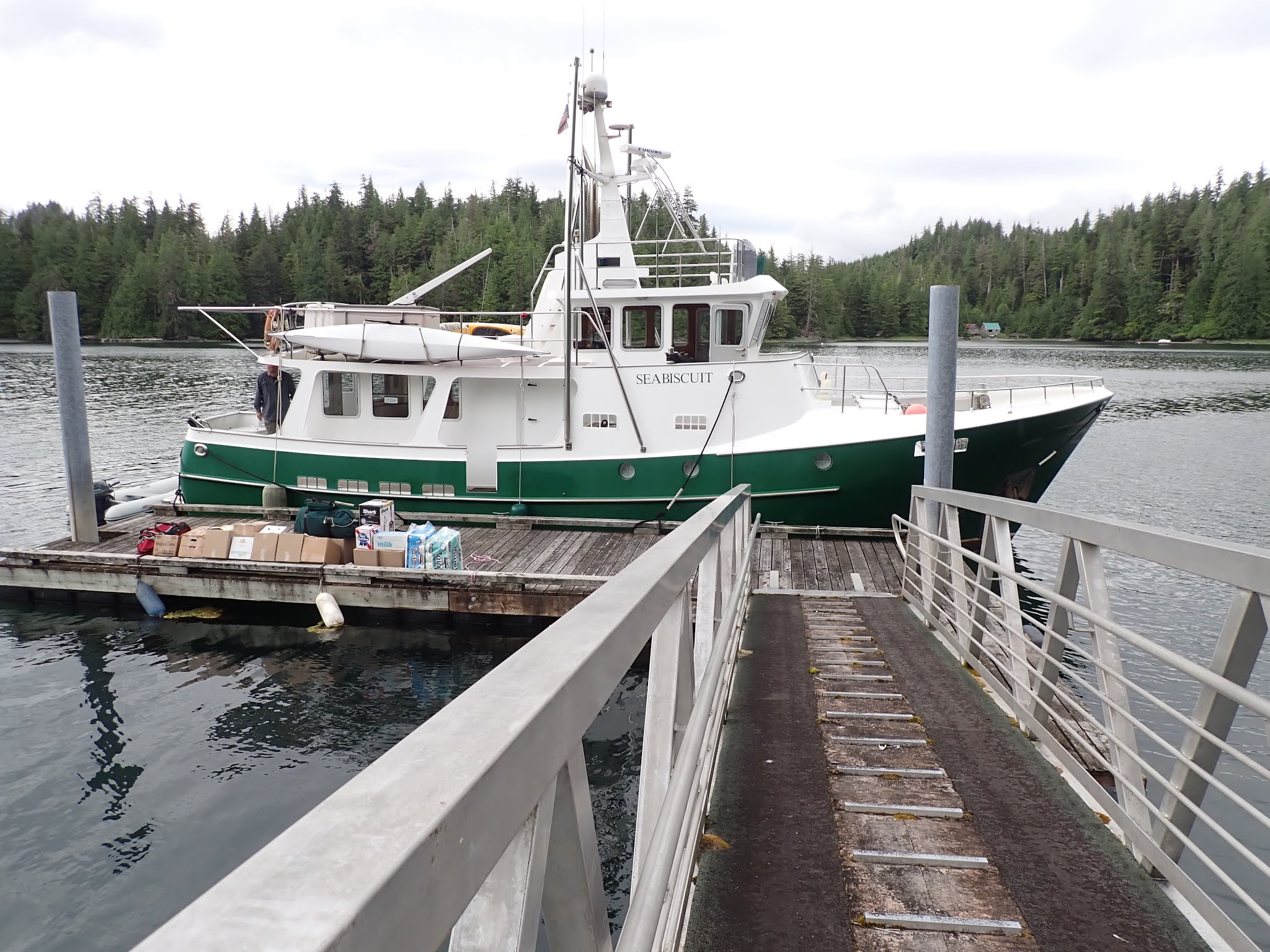
hours): We were planning to visit Floyd and Darlene at their cabin in Dora Bay and since they were in Ketchikan, we made arrangements for Darlene, Moxie and their supplies to ride over with us on the boat rather than on the float plane. We spent the morning loading boxes of groceries, supplies and household goods. Floyd was scheduled to fly to their cabin in Dora Bay but, because of the fog, his flight was cancelled and he rode along with us. We got all of their stuff loaded and pulled away from the dock at 13:00 for the 28 mile voyage up the Tongass Narrows and across Clarence Strait to Dora Bay.
 |
Cruising from Ketchikan to Dora Bay, Floyd and Moxie and boxes of good in the saloon
|
 |
| Cruising from Ketchikan to Dora Bay, Darlene and Dave in the pilot house |
About 17:00 we tied up at a neighbor's dock, near Floyd and Darlene's place, and got busy. We launched the dinghy and Dave took Floyd, Darlene and Moxie over to their beach, then he came back followed by Floyd in their skiff. We transferred all the boxes from the boat to the dock to the skiff then went back to their beach to unload onto Max, their garden tractor. Max carried the boxes up the beach to the cabin stairs and then we carried the boxes up the stairs. By the time we finished everyone was tired. We left Darlene and Floyd so that they could get the perishables stowed in the refrigerator and freezer and dinghied back to the boat for supper.
 |
| Seabiscuit at the neighbor's dock in Dora Bay. Darlene and Floyd's boxes are stacked along the dock rail ready to be loaded onto their skiff. |
 |
| Floyd, Dave and Darlene unloading boxes from the skiff to Max. |
We spent most of Saturday with Darlene and Floyd. We started with fresh roasted brewed coffee then Darlene taught me how to make a cheese ball using her smoked salmon plus fresh cilantro from her garden and garlic. We had the cheese ball with crackers and pasta salad with a special olive salad mix for lunch then we went back to the boat for our afternoon nap. We went back to the cabin late afternoon for more visiting then Darlene cooked us a delicious supper: broiled venison back-strap with mushroom sauce, corn-on-the-cob and sea asparagus, something we hadn't tried before.
 |
| Darlene and Moxie tuning up the HAM radio so she can check us all into the Bush Net |
After supper, we walked outside to check out Darlene's garden and into the woods to search for
coralroot orchids and step-on-me orchids. We came back to the cabin and Darlene checked all four of us into the Bush Net, a nightly HAM radio net that operates from 20:00 - 20:15 Alaska Time on 7093 KHz and from 20:15 - 20:30 on 3920 KHz. This is a controlled social net that we regularly check into and all are welcome to participate. After that Dave and I dinghied back to the boat and got everything ready for our departure in the morning.
 |
Sea asparagus on the beach near the neighbor's dock.
We both liked it so we picked some before leaving in the morning. |
 |
| Frog Mountain in Dora Bay |
Sunday, July 18, 2021 – Dora Bay, Alaska to Metlakatla, Alaska (29 nm, 4
hours): After checking into the Boater's Net with Darlene, we went ashore and picked some sea asparagus then got underway. Darlene, Floyd and Moxie waved goodbye from their beach as we cruised by. There were lots of sport fishing boats out around the islands near the entrance to Cholmondeley Sound on the west side of Clarence Strait and there was a seine fishery open so there were a lot of seiners on the east side of the Strait near Gravina Island.
We pulled into the harbor at Metlakatla and were greeted by a Covid Tracker as we tied up to the dock. She took down our names and information and asked where we had come from. The community is still under lock down status and masks are required indoors.
Metlakatla is the only Indian Reservation in the state of Alaska and has a very interesting history as described in the linked article. We settled in and had lunch then went for a walk around the community.
 |
| B near the Metlakatla Sign |
 |
| Petroglyph carvings near the Wil la mootk Counseling Center |
 |
| Dave picking salmon berries in Metlakatla |
Monday, July 19, 2021 – Metlakatla, Alaska to Kanagunut Island (56
nm, 8 hours): It was bright and sunny when we left the harbor this morning. There was a gill net fishery open today so we stayed away from the coast of Annette Island to avoid the fishing nets. We stopped to fish south of Duke Island. I caught and released a small rock fish then we moved south east to Club Rocks where we caught and released one small rock fish and one very small ling cod. No keepers but at least we didn't get skunked.
We pulled into the south entrance of Lincoln Channel and anchored up in a cove on Kanagunut Island. There was a small work float nearby and several gill netters came in and tied up to it later in the evening. We noticed that the freezer temperature was rising so we defrosted it thinking that the thermostat bulb might be frozen and not triggering the compressor. That didn't work but it was late and we decided save the trouble shooting for tomorrow.
Tuesday, July 20, 2021 – Kanagunut Island, Alaska to North
Kelp Passage, BC via Prince Rupert (51 nm, 7 hours): The US / Canada border was still closed to
non-essential travel when we were ready to cross the border and travel south from Alaska back to the
lower 48 states. The same rules applied as when we transitted from south to north – no stopping for fun, etc.
 |
| Alaska in the rearview mirror |
We crossed Dixon Entrance and put up our Canada and quarantine flags then made our way to the north entrance of Venn Passage and wound our way down to Prince Rupert. At the customs dock, we cleared into Canada, submitted
our transit plan to CBSA then continued south to North Kelp Passage where we anchored up for the night.
We did some more troubleshooting on the freezer - removed all of the food (of course the freezer was full because we had just stocked up in Ketchikan) and disassembled the cold plate and the thermostat. We have a spare thermostat on board but the wiring/electrical connections are very different than the one installed. Dave figured out a way to by-pass the thermostat with a jumper so that we could run the compressor at low speed and he rigged up a fan to cool the compressor so at least we have a temporary fix until we can get the parts for a real fix.
 |
| The wiring to the existing thermostat control |
 |
| Our spare thermostat. You can see the difference in the electrical connection types. |
 |
| Our temporary fix for the freezer, a jumper to turn on the compressor and a portable fan to cool it. |
 |
| Sunset at North Kelp Passage |
Wednesday, July 21, 2021 – North Kelp to Coghlan
Anchorage (57 nm, 8.5 hours): Anchor up at 7:15 this morning for the run down Grenville Channel. It was rainy and overcast for most of the day but we did see a little sun and some spots of blue sky. We anchored up at Coghlan Anchorage about 16:00 and settled in for the night.
 |
| Dave grilling tri-tip for supper, Coghlan Anchorage, BC |
Thursday, July 22, 2021
– Coghlan Anchorage to Bottleneck Inlet (57 nm, 8.3 hours): Anchor up at 6:30 this morning. Overcast and light rain and an uneventful voyage. We anchored up in Bottleneck Inlet ~15:30 and settled in for the night.
 |
| View from the pilot house as we travel south down the inside passage |
Friday, July 23, 2021 –
Bottleneck Inlet to Fancy Cove (57 nm, 8.3 hours): Anchor up at 7:30 this morning. It was overcast and rainy and the wind was blowing. We were planning to travel south down Finlayson Channel to Seaforth Channel via Millbanke Sound but we saw Captain Kidd, a boat we have been travelling with, turn into Jackson Passage, a protected scenic channel between Finlayson and Mathieson Channels. We followed them through then also used Reid Passage to avoid the wind and seas in Millbanke Sound. Although slightly longer, by taking this route we avoided the exposure to the ocean swells, wind and seas in Millbanke Sound at the western end of Seaforth Channel. We anchored up for the night in Fancy Cove on the south shore of Lama Passage.
 |
Captain Kidd at anchor in Fancy Cove.
We followed them through Venn Passage, north of Prince Rupert, to the Customs dock and we have been sharing anchorages every night since then. |
Saturday, July 24, 2021 – Fancy Cove to Millbrook Cove
(52 nm, 7.5 hours): It was raining this morning. Captain Kidd left the anchorage ~6:00; we had our coffee and breakfast then left ~7:30. They were headed to Fury Cove for the night. We decided to go further south and we anchored up in Millbrook Cove.
 |
| Logs, driftwood and flotsam along the shores of the islands that we wove through on our way in to Millbrook Cove. |
Sunday, July 25, 2021 – Millbrook Cove to Spout Island
Cove (64 nm, 9 hours): It was raining again this morning but the winds were light and there were no wind waves. We left Millbrook Cove at 7:30 and headed south around Cape Caution.
 |
| The marker at Cape Caution |
Other than dodging logs and flotsam along the way, the voyage was uneventful and we anchored up in Spout Island Cove ~15:30. |
The Curve of Time anchored in Spout Island Cove.
Built in 1959 in Holland, she is a North Sea Trawler named after a Muriel Wylie Blanchet memoir about travelling the BC coast in a boat with her five children (an excellent read if you can find it). Previously named "Moby Dick" and owned by Green Peace, she now does charter kayak and eco-tours along the BC coast. |
Monday, July 26, 2021– Spout Island Cove to Gowlland
Harbor North (72 nm, 9 hours): We had an easy morning this morning, doing boat chores and watching the activity in the cove. It started out foggy, but by the time we were ready to leave at 11:00, the fog had mostly burnt off. The late departure was so that we could make the run down Johnstone Strait and arrive at Seymour Narrows close to slack water at 20:15. We had the current against us for the first couple of hours, then the tide changed and we had it with us for the rest of the day. Our speed was all over the place, from 6 knots when we had the current against us in Blackney Passage to over 12 knots in Johnstone Strait where the current was running 5 knots or more.
 |
| A tug with an empty log barge traveling west in Johnstone Strait |
We picked up enough speed along the way to arrive at the narrows an hour before slack water. Maximum flood today was 13.6 knots at 16:48, so by using the 50/90 rule of thumb to calculate the speed of the current an hour before slack, we figured it was still running at over 6.5 knots (the 50/90 Rule gives you “… the SPEED OF THE CURRENT at the end of each hour" in a 6 hour tide cycle. Counting from slack, the current will flow at 50% of its maximum speed at the end of the first hour, 90% at the end of the second hour and full 100% or maximum speed at the end of the third hour and then back to zero with the same steps. The full rule should be stated as 0/50/90/100/90/50/0).
There were two tugs with a log tow waiting just north of the narrows for slack water. We watched one of the tugs go through (no logs in tow) with no issues. We couldn't see any angry, roiling water in the middle of the narrows so we decided it was okay to go through early. Our calculations were pretty accurate and we went through with our speed over ground (SOG) over 12 knots. Other than some swirling in the currents as we rounded Race Point south of the narrows, we didn't have any issues. We made our way south down Discovery Channel and into Gowlland Harbor North where we anchored for the night.
Tuesday, July 27, 2021 – Gowlland Harbor North to Codfish
Bay (59 nm, 8 hours): Anchor up at 6:30 this morning to catch the last of the flood flowing south down Discovery Passage and into the Strait of Georgia. The currents flow both ways around Vancouver Island and meet south of Cape Mudge and we were able to time our voyage to get a push from the current for most of the day. We anchored up mid-afternoon in Codfish Bay on the east side of Jedediah Island. It was a nice sunny afternoon so we stored some of our rain gear and laid out the shrimp and crab traps and lines to dry.
Wednesday, July 28, 2021 – Codfish Bay to Clam Bay (38
nm, 5 hours): A short voyage today down towards Nanaimo, through Dodd Narrows and into the Gulf Islands. It was great to see the sun out again today and we had an uneventful voyage. We anchored up in Clam Bay between Thetis and Penelakut Islands, settled in and did some outside chores. The anchorage was busy and by late evening there were 20 other boats anchored in the area.
Thursday, July 29, 2021 – Clam Bay, BC to Roche Harbor,
WA (30 nm, 4.5 hours): Another short run today. Anchor up at 8:30 for a nice cruise across the border to Roche Harbor. We used the CBP Roam App to clear customs into the U.S. We came through the northern entrance to Roche Harbor ~12:30 and found a zoo inside. There were boats of all sizes anchored throughout the harbor. The VHF was buzzing with boats calling the harbor master to get a slip or to get on the waiting list for a slip. Kayakers were paddling around and people in dinghies and skiffs were checking their crab traps. We called the harbormaster to get on the waiting list for a slip. He told us that the chances for today were slim so we anchored up in the harbor amongst the crowd and settled in. We spent the afternoon doing a few light chores and watching the activities in the harbor.
 |
| M/V Phecal Phreak, the Roche Harbor pump-out boat, is very busy during the summer season. |
Friday morning we had our breakfast and coffee, checked into the southern portion of the Boater's Net then called the Harbormaster on the VHF to get on the waiting list for a slip. Instead of a reservation system, they start a new wait list each morning, with boats calling in via the VHF radio starting at 8:30; there were a few boats that tried to call in before then but the harbor didn't respond until the 8:30 bell had rung. Then, as boats leave the slips, the harbormaster phones each boat and gives you your slip assignment. Check out time is noon so many slips don't become available until then. We had some time to kill, so Dave suited up in his dive gear and went into the water to check the anodes, all good, and to scrape barnacles off the hull and props. We got a call from the harbormaster at 12:30 saying that our slip was available so we heaved anchor and moved into the marina. We had lunch at the cafe and took a walk around the marina, then got a few groceries, did some laundry and watched the activities around the docks.
Saturday morning a rain shower moved through the area which everyone was glad to see. We washed some of the salt off the boat, did boat chores and set our crab and shrimp traps, lines, buoys and bait bags up for sale on the swim platform. Early afternoon we went for a walk in the San Juan Island Sculpture Park. Later than afternoon somebody stopped by and bought our traps. We had supper at McMillin's then called it a night.
 |
| A sculpture in the San Juan Island Sculpture Garden |
 |
| Wild flowers in bloom, San Juan Island Sculpture Garden |
Sunday, August 1, 2021 - Roche Harbor to Port Angeles (37 nm, 5 hours): Sunday morning we watched the boats around us start to begin to prepare to initiate to leave the marina. Check out wasn't until noon (did I mention that already?) and two of the boats nearby planned to leave at 11:59. We were blocked into our slip and couldn't leave until the boat in front of us left. We didn't see them stir until after 10:00, then watched them take out the trash, go to the grocery, fill water, get their tanks pumped out by the Phecal Phreak and take the dog for a walk. They fired their engines up at 11:45 and got away from the dock 5 minutes before noon. We followed them out, turned south down Mosquito Pass and into Haro Strait. We turned into the Strait of Juan de Fuca where we had the eb current flowing from east to west and the wind blowing 20 - 25 knots from the west, so we had the classic ebb current opposing the wind and short steeps waves. Once we got inside the Port Angeles Harbor, Ediz Hook protected us from the seas. We tied up alongside the guest dock in the Port Angeles Boat Haven then walked downtown for supper.
 |
| The Lime Kiln Lighthouse on the west side of San Juan Island |
We decided to stay in Port Angeles for a few days to wait for the wind to calm down in the Strait of Juan de Fuca before heading west and then south around the corner into the Pacific We've been taking advantage of being in town and doing our normal town activities.
Until Next Time…