Thursday, September 24, 2020

Ketchikan, Alaska to Roche Harbor, Washington, Transit through BC (September 8 - 24, 2020)

 Location:  Anacortes, Washington

Clear sky between the fog banks at the north end of the Grenville Channel


Tuesday, September 8, 2020 – Ketchikan, Thomas Basin to Lincoln Channel, Sitklan Island (43 nm, 6 hours):  We made a few phone calls this morning, took up the trash then left the dock just after 9:00.  It was a nice, sunny day with very little wind and calm seas.  There was a fishery open along the west coast of Peninsula Ridge and around Cape Fox but most of the boats were close to shore so not many to weave around.  It is a long run from Ketchikan to Prince Rupert (~80 nm) so we decided to anchor up just north of the border in Lincoln Channel, between Kanagunut Island and Sitklan Island, and cross the border tomorrow morning.  Just after sunset, a few fishing boats and a large fishing tender came into the channel to anchor up for the night.

Anchorage at Sitklan Island, just north of the Alaska, US / British Columbia, Canada border
Wednesday, September 9, 2020 – Sitklan Island to North Kelp Passage via Prince Rupert (52 nm, 7.1 hours):  We heaved anchor at 6:00.  The fishery was still open this morning and we had one boat to go around as we exited Lincoln Channel.  It was foggy with less than ½ mile visibility for most of the voyage.  At the north end of Tugwell Island, we announced on the VHF that we would be transiting the Venn Passage east to west.  The Venn Passage is a short (~4 nm), winding, shallow water passage around the north side of Digby Island.  If you are traveling from Alaska to Prince Rupert, it can save as much as 12 miles (~1.5 hours at our normal cruising speed) compared to going south around Digby Island.  As we entered the passage, the visibility decreased and was less than 1/8 of a mile.  We kept a close lookout for the channel markers and blew our whistle (fog horn) when we saw targets approaching on the radar that we couldn’t see through the fog.   After exiting the east side of the narrows, we proceeded to the Customs Dock to clear in to Canada.  Two agents came down to the dock to take our information and to inform us about the COVID-19 protocol while we were transiting.  We let them know that we would be anchoring every night but had enough fuel, water and provisions such that we wouldn’t need to go ashore unless we had an emergency.  They took down the list of our tentative anchorage locations for each night and asked that we call them once we cleared US Customs so they could close out their file.  After we finished our check in, we got underway and headed south to North Kelp Passage for the night.  We anchored up and settled in.  We won’t be doing any crabbing, shrimping or fishing on our way through BC so we rinsed our gear and put it away for the season.

Dragon cloud over the anchorage at North Kelp Passage
Thursday, September 10, 2020 – North Kelp Passage to Coghlan Anchorage (58 nm, 7.2 hours):  Anchor up this morning just after 8:00.  The morning started off clear but we were into the fog with our navigation lights and radar on within 30 minutes.  The fog finally cleared just south of Baker Inlet.

A tug and barge appearing out of the fog north of Baker Inlet, Grenville Channel
The wind picked up and was blowing from the north 25 – 30 knots as we made our way down Grenville Channel, aka “the ditch”.  The wind died down as we turned to the southeast at Morning Reef.  We spotted a pod of whales bubble feeding near Waterman Point so we stopped to watch them for a while, then turned into Coghlan Anchorage.  There was one sailboat anchored up which was a big change from the last time we were here when there were 20 – 30 boats in the area.  We anchored up about 15:30 and did a few maintenance chores.

Sunset Coghlan Anchorage
Friday, September 11, 2020 – Coghlan Anchorage to Bottleneck Inlet (58 nm, 7.5 hours):  We heaved anchor at 7:45 this morning.  The winds were light, the seas were calm and there was no fog so a good day for traveling.  We checked into the southern portion of the Great Northern Boater’s Net (3870 kHz at 8:00 Pacific Time) for the first time this year.  We had been talking to Darlene who runs the northern portion of the net during the summer but she shut down on September 1st because there weren’t many boaters up in Alaska this season.  We heard lots of reports from Washington, Oregon and Southern BC about smoke in the air from the forest fires. 

Waterfall along the shore, Fraser Reach
We stopped to watched some whales bubble feed near Kingcome Point on the north side of Princess Royal Island.  There were a lot of sealions playing along the shore line and on the buoy in Hiekish Narrows.

Whales bubble feeding

Whales feeding near the shore

Sea lions on the buoy in Hiekish Narrows
We followed another yacht into Bottleneck Inlet and anchored up behind them.  The sailboat that was in Coghlan Anchorage last night also came in and anchored up for the night.

Saturday, September 12, 2020 – Bottleneck Inlet to Wigham Cove (39 nm, 5.4 hours):  Anchor up at 8:00 this morning.  It was overcast with light winds and calm seas.  We saw two sunfish amongst the islands on the north side of Seaforth Channel as we came around the corner from Finlayson Channel.  We were anchored up in Wigham Cove by 13:30 and settled in for the afternoon.  It was nice outside so we did some reading on the stern and did a few boat chores.  We watched a flock of ~40 sandhill cranes fly overhead, going south for the winter.

Lighthouse at Robb Point in Seaforth Channel
Sunday, September 13, 2020 – Wigham Cove to Pruth Bay (43 nm, 6 hours):  We left the anchorage at 8:30 this morning.  It was overcast with light winds and calm seas so we decided to take the outside route down Raymond Passage and between Goose Island and the McNaughton Group instead of the inside route.  The voyage was uneventful and we anchored up in Pruth Bay about 14:30.  The Hakai Institute is located at the head of Pruth Bay and, in normal years, they allow boaters to come ashore to use the guest wifi and to walk the trails to the various beaches.  This year, there were CLOSED signs on the docks and we saw one dinghy get turned away from the docks.

Monday, September 14, 2020 – Pruth Bay to Allison Harbour (52 nm, 7 hours): This  morning we heaved anchor at 7:00 for our journey south around Cape Caution.  The weather and currents around Cape Caution can determine whether you have a smooth or a troublesome voyage.  Both looked good this morning;  the wind and seas were calm and the currents at Slingsby Channel were forecasted to be flooding by the time we got south of the cape.  It was foggy as we left the anchorage so we had our radar and our navigational lights on.  We made it around the cape with no issues and cruised into Allison Harbour mid-afternoon and anchored up. 


Jellyfish in Allison Harbour
Tuesday, September 15, 2020 – Allison Harbour:  We decided to take a day off today to do some chores and maintenance.  The wind was forecast to blow over 20 knots in Queen Charlotte Strait and we didn't want to beat ourselves up.  It was nice to take a break.

Wednesday, September 16, 2020 – Allison Harbour to Cullen Harbour (39 nm, 5.2 hours): We left the anchorage at 8:00 this morning and continued our journey south.  


An island near the entrance to Allison Harbour.
It was foggy with about 1 nm visibility for most of the voyage so we had the lights and radar on.  We pulled into Cullen Harbour at 13:00 and anchored up in the northwest lobe.  We watched a sailboat come in late afternoon, launch his dinghy and row around the cove putting out his crab pots - we were jealous of him being able to row around and also of the crabs he was likely to catch - as a vessel in transit through BC during the COVID pandemic we were required to stay aboard and to make the most direct route to Washington.

Thursday, September 17, 2020 – Cullen Harbour to Port Neville (39 nm, 5.5 hours): We heaved anchor this morning at 8:30.  It was foggy but we could see the sun trying to break through the fog and the smoke.  There is a lot of logging activity amongst the islands on the north side of Johnstone Strait and it was a new moon, which means higher high tides and lower low tides, and, because of these two things, there was a lot of flotsam in the water that we had to dodge today.  We pulled into Port Neville and were anchored up by 14:00.  We had a good cell phone signal so we spent the afternoon catching up on e-mails and the internet.

The mid-afternoon sun in Port Neville trying to break through the fog and the smoke from the fires further south.
Friday, September 18, 2020 – Port Neville to Maud Island (44 nm, 5.4 hours): 
Today was our day to transit Seymour Narrows, a narrow section of Discovery Passage and the main channel used by cruise ships, fishing boats and tugs and barges transitting the inside passage.  Currents through the narrows can run as much as 15 knots and with the new moon, today they were running 13 knots.  Ripple Rock used to be in the center of the narrows, but they blew it up in 1958 to make it safer for ships to go through.  There are a lot of good You Tube videos about the Ripple Rock explosion; this is the link to one of them.  In order to arrive near slack water we calculated that we should depart our anchorage at Port Neville at 13:00.  We spent the morning on the internet and doing administrative chores.  If you remember the pictures of the crawfish like creatures from the previous blog, we finally learned that they are Munida Quadrispina, a squat lobster.  In Alaska they call them "krimp".  You can eat them but they don't have much meat.

Anchor up at 12:45 and we got underway.  We had the current pushing us the entire way and our speed over ground got up to over 13 knots with a 6 knot current pushing us through Race Passage and again through Ripple Shoal near Camp Point.  Along with the speed there were a lot of whirlpools with logs and other flotsam getting swirled around with us.  Because the current was with us, we were on track to arrive at Seymour Narrows at 17:00 when the current there would still be running over 9 knots.

As we cruise, we like to listen to the VHF radio and the conversations between "Traffic" (Vessel Traffic Services (VTS)) and various vessels.  There is a VTS check point just north of Seymour Narrows and another on the south side.  As vessels reported in, Traffic would ask them what time they planned to transit the narrows.  They would reply and then Traffic would say something like "the current at that time will be running 9 knots, do you feel comfortable transiting at that speed?".  More times than not, the vessel would respond and say that they would slow down and wait to transit the narrows after the current decreased and it was closer to slack water.  We are too small to need to talk to Traffic but we heeded the warnings they gave others and pulled into Elk Bay to wait before proceeding to the narrows.

Dall Porpoises riding our bow wake just north of Seymour Narrows

After an hour of drifting, we fired the engine back up and continued south down Discovery Passage.  Just north of the narrows, we had a small pod of Dall's porpoises come out and cruise our bow wake.  This is the first pod we've seen this year and we enjoyed watching them.  We got to the narrows about 15 minutes before slack water with the current running less than 2 knots and went through with no issues.  We made our way around the south side of Maud Island and anchored up in front of a small causeway that connects Maud Island to Quadra Island.  Seymour Narrows is on the other side of the causeway and we watched an Alaskan State Ferry and a tug and barge make their way through going south.

The north shore in the Maud Island anchorage.  The figure under the tree is a man made out of logs.

The Alaskan State Ferry Kennicott transitting Seymour Narrows.
Saturday, September 19, 2020 – Maud Island to Tucker Bay, Lasqueti Island (58 nm, 8.5  hours): The anchorage was very quiet although we could hear the roar of Seymour Narrows on the other side of the causeway.  Anchor up at 6:45 this morning to catch the last of the flood in Discovery Passage and the ebb down the Strait of Georgia.  The currents on the inside of Vancouver Island (the east side) flood and ebb from both the north and south and meet between Shelter Point and Kuhushan Point (between Campbell River and Comox).  We should have left about 45 minutes earlier as the ebb current was already flowing north before we got to Cape Mudge and our speed over ground got as low as 4.0 knots.


The Cape Mudge Lighthouse
We got back up to our normal cruising speed once we got out into Sutil Channel.  It was good traveling weather, overcast but not foggy, with light winds and calm seas.  Mid-afternoon we anchored up in Tucker Bay on the north side of Lasqueti Island.  While we were sitting in the pilot house listening to Traffic, we saw a skiff in the cove next to us having problems starting their outboard.  We watched for a while then launched the dinghy and gave them a tow back to their cabin on the island.

Sunday, September 20, 2020 – Tucker Bay to Clam Bay (41 nm, 5.8 hours):  We left the anchorage at 8:00 this morning to time our arrival for slack water at Dodd Narrows which is just south of Nanaimo.  Currents in Dodd Narrows can run as high as 9 knots, today max was 8.0 knots, so it is best to transit near slack water.  As we left the Strait of Georgia and entered Fairway Channel, we saw a group of sailboats out racing and enjoying the nice weather.  We got to the north entrance of Dodd Narrows about 45 minutes prior to slack.  The current was running ~2.5 knots with us and we decided it was ok to go through.  The narrows is only about 600 feet long with cabins on both sides and people were sitting along both sides of the shore watching boats go through.  We waved as we went by.  Our anchorage for the night was in Clam Bay near the north shore of Penelakut Island.

Sunrise at Clam Bay
Monday, September 21, 2020 – Clam Bay to Roche Harbor (31 nm, 4.4 hours):  Today was our last day cruising/transiting British Columbia.  We heaved anchor at 9:00 and headed toward the Canada / USA border.  

A barge loaded with logs in Captain Passage.between Salt Spring and Prevost Islands.
We crossed the border at 12:00 and took down our Canadian Flag.  We called US Customs and Border Patrol to check in but were told we would need to go to the customs dock in Roche Harbor.  We could hear a lot of boats calling Roche Harbor on the VHF and asking for slip assignments so we gave them a call to make sure they had space available.  They said they had plenty of slips and that we could stop in at the office to get a slip assignment after we cleared  Customs.

Approaching Roche Harbor
We cleared Customs with no issues and pulled into our slip at the transient dock.  It was a beautiful day and we took an afternoon walk to the Sculpture Park then had a gourmet supper at McMillian's.

B with Large Marge and her two cubs in the Sculpture Park.

Tuesday, September 22, 2020 – Roche Harbor, WA:  Roche Harbor is a resort with a large marina, several restaurants, a hotel, a spa, cabins, a swimming pool, a grocery store, etc.  Although it is late in the summer season and there is a COVID pandemic, Roche Harbor seemed very busy.  People were wearing masks and social distancing but other than that operations felt normal.  We spent the morning doing chores then had lunch at the cafe.  For our afternoon walk we went back to the Sculpture Park to pick black berries.  There was a sign near the entrance that said pick all the black berries and mint that you want so we took two plastic containers and filled them up.

Dave picking black berries at the Sculpture Park

Our black berries washed and ready to eat.

Wednesday, September 23, 2020 - Roche Harbor:  The wind picked up over night and it rained most of the day today.  We spent the morning doing boat chores and walked the docks during a break in the rain after lunch.

Thursday, September 24, 2020 - Roche Harbor to Cap Sante Marina, Anacortes  (28 nm, 4 hours):  We left Roche Harbor in the rain this morning and cruised east through the San Juan Islands to Anacortes.  We'll stay here one night, do a few chores and get a few groceries and then move to La Conner tomorrow.


Until Next Time…

Tuesday, September 8, 2020

Auke Bay to Ketchikan (Aug 24 - Sept 7, 2020)


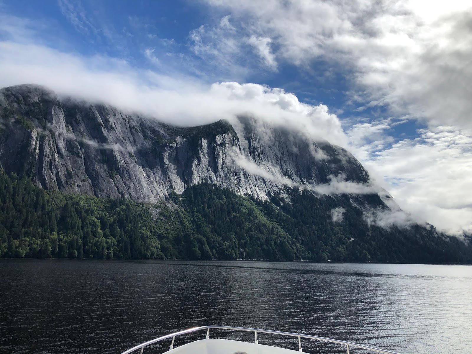
Location:  Ketchikan, Alaska

A brown bear catching a salmon in Pack Creek


Monday, August 24, 2020 – Auke Bay:  We did a few town chores today including riding the bus to Fred Meyer for groceries and lunch.  The bus had the front section roped off, masks were required and they were limiting each bus to no more than 14 people.  We took an afternoon walk out to the boat ramp and back.  It started to rain about 17:00 so we had happy hour and supper on the boat.
Point Retreat Lighthouse on the northern tip of Admiralty Island
Tuesday, August 25, 2020 – Auke Bay to Taku Harbor (33 nm, 4.3 hours):  We left the dock at 8:00 this morning and headed south to Taku Harbor.  It was overcast and raining.  We saw some 20 knot winds and had the current against us as we made our way down the west side of Douglas Island.  The visibility improved as we turned south into Stephens Passage.  A gill net fishery was open and we saw a few small fishing boats along the shore.  We pulled into Taku Harbor ~13:00 and tied up to the floating dock in the southwest corner.  We spent the afternoon doing maintenance and chores, reading and voyage planning.

Wednesday, August 26, 2020 – Taku Harbor to Windfall Harbor (58 nm, 8 hours): We left the dock at 7:30 this morning.  There was some current pushing us away from the dock and we struggled to release our stern line.  There was a boat tied up on the other side of the dock and he came out to give us a hand.  Our crab trap had one small female inside and we let it go.  We cruised south down Stephens Passage, around Point Hugh and then north up Seymour Canal.  We could see whales spouting along both shores.  We watched one slap his tail over and over, another slap his flipper and two others breach, so it was very entertaining.  On the northwest shore of Tiedeman Island, we saw ~100 seals hauled out on a sand spit.  We turned into Windfall Harbor and dropped off our crab trap then went and anchored in front of a creek flat on the west shore.  We spent the afternoon watching the brown bears, we counted 7, feeding on salmon.

The creek flats on the west shore of Windfall Harbor. 
The black spots are the bears and the small white spots are the seagulls.
Thursday, August 27, 2020 – Pack Creek Windfall Harbor (7 nm, 1.2 hours):  We spent the morning watching the bears in the creek flats next to us and at the head of the bay.  It was overcast, calm and not raining which was a nice change.  We ate our lunch then heaved anchor at 12:30 and headed up the bay towards Pack Creek.  Pack Creek is a brown bear viewing area managed by the US Forest Service.  Permits are required to go ashore and most years you need to book far in advance in order to get a permit but with fewer travelers than usual and no cruise ships, we didn’t have any issues getting a permit.  We anchored up near the creek flats and launched the dinghy to go ashore.  A clothes line system is set-up for dinghies and small boats.  You go in to a sand bar near the beach, tie the dinghy to the clothes line, wade ashore and use the line to send the dinghy out into deeper water.  A ranger met us and gave us an overview of the area, then we headed towards the viewing area.  There was one other group of three people at the viewing area and they decided to come back to the beach as we were walking in.  No sooner had they passed us, then a mother bear and two cubs came out of the woods headed for the creek flat.  We waited until they were well away from the path before proceeding.

A mother bear and her two cubs walking out of the woods to the creek flats.
A ranger met us at the viewing area and pointed out the bears.  There were 20 in the area; he said that was the most he has seen at one time after working there for 10 seasons. 

Mother bear and her cub in the Pack Creek flats

Five bears upstream from the Pack Creek flats

Dave watching the bears from the Pack Creek viewing area
Mother bear laying on her side so that her cub could feed.  She was purring while he was feeding.


Seabiscuit at anchor near Pack Creek
We stayed at the viewing area for a couple of hours, watching the bears, then decided to hike to the viewing tower further upstream.  We passed a deer on the way in and watched one bear catching salmon in the creek before he went around a bend and out of sight.
Dave on the hiking trail to the viewing tower.

A deer on the hiking trail

B in front of the viewing tower
We hiked back out to the beach and dinghied back to the boat.  The wind was forecast to pick up overnight, so we cruised back towards the head of the bay to anchor up on the east side where we would be protected from the wind.


A mother bear and cub walking along the beach in Windfall Harbor

Friday, August 28, 2020 – Windfall Harbor:  Rain, rain and more rain today.  We watched the bears across the bay in the creek flat and did boat chores and maintenance.

Saturday, August 29, 2020 – Windfall Harbor to Portage Bay (65 nm, 9.1 hours):  This morning we heaved anchor at 7:15.  We picked up the crab trap and had two keepers inside, our first crabs of the season.  We cruised south down Seymour Canal.  It was foggy for most of the voyage but once we got close to the entrance, the fog lifted and it was a glorious sunny day.  

Three crabs in our trap.  We kept two and let the smallest one go.

Cruising along through the fog in Seymour Canal.

Summer came on a Saturday so we went fishing.  We tried our luck near Sail Island then moved out to some pinnacles just east of the island.  Dave caught a big halibut, ~60 pounds.  We took a few photos then released it.  There were a lot of whales feeding in the area and sea lions along the coast of Sail Island.

Dave reeling in a big halibut east of Sail Island.
The halibut Dave caught.  We estimated it was ~50" long and 60 pounds

It looked like rain was moving in, so we reeled up our lines and finished our trip to Portage Bay.  We anchored up just south of the green day marker, settled in and had crab for supper.

B ready to enjoy fresh crab for supper.
Sunday, August, 30, 2020 – Portage Bay to Petersburg (22 nm, 3.5 hours):  Anchor up at 9:45 this morning for our short run in to Petersburg.  It was foggy, windy (20 – 25 knots) and raining.  We timed our voyage to catch the slack tide at the Petersburg North Harbor and were tied up in our slip by 13:30. The rain let up late afternoon so we took a walk around town and stopped at the Mexican restaurant and got supper to go. 

The Petersburg Fishermen's Memorial.
A log tug boat tied up in Hammer Slough at low tide.
Monday, August 31, 2020 – Petersburg:  Town chores and boat chores and maintenance today in between the rain drops.  We heard on the radio this morning that it was one of the rainest summers on the record books.  Both Ketchikan and Petersburg broke their records for the amount of rainfall during June, July and August.  

According to the Petersburg Pilot "This summer's wet weather set a record for the most summer rainfall ever in Petersburg with 31.6 inches of rain, just barely surpassing the previous record of 31.06 inches of rain in the summer of 2015, according to data from the National Weather Service in Juneau."  

Ketchikan had 47 inches of rain.  From Ketchikan's KTOO "Of the 90 or so days from June through August, Ketchikan saw 68 days with measurable rainfall. The city’s previous record, 67 days, was set in 1933 and last tied in 1966."  Read the full Ketchikan article here.  

A guy from Juneau told us "It only rained twice this summer, once for 65 days and once for 25 days".

Tuesday, September 1, 2020 – Petersburg to Exchange Cove (40 nm, 5.3 hours):  Town chores and grocery shopping this morning.  We left the harbor at 12:45 to catch the currents in the Wrangell Narrows.  The Narrows is 21 nautical miles long with more than 60 channel markers.  It floods from both ends and the currents meet near the middle.  If you time it right, you will get a push south from the flood current in the north part of the narrows and the ebb current in the south part of the narrows.  We met a tug and barge coming north near Blind Point.  He needed the whole channel to maneuver around the turns so we pulled off into a wide spot and let him pass.  

Screen shot from our navigation app of the section in the Wrangell Narrows where
Seabiscuit, going south, meets the tug Western Titan with barge in tow going north.
We exited the channel and crossed Sumner Strait.  There was a gill net fishery open west of Zarembo Island and one of the fishermen called us on the VHF and gave us some advice on where most of the boats were located and how best to avoid their nets which was very helpful.  We passed a huge raft of sea otters just before our turn into Exchange Cove.  We anchored up close to the mud flats at the head of the cove.  And yes, you will be surprised to hear that it rained.

Wednesday, September 2, 2020 – Exchange Cove to Snug Cove (41 nm, 5.9 hours):  We started off our day with scones we bought from The Salty Pantry in Petersburg which were a nice treat.  Anchor up at 12:00 in order to catch the ebb current going south.  It was overcast and raining.  The gill net fishery that was open yesterday ended at 12:00 today so there were no fishing boats or nets to dodge.  The voyage was uneventful and we wove our way into Snug Cove and anchored up behind the island ~18:00.

Early morning departure from Snug Cove.  The days are getting shorter.

Thursday, September 3, 2020 – Snug Cove to Klu Bay (63 nm, 8.9 hours):  We left Snug Cove at 6:00 to catch the ebb tide in Clarence Strait and then the flood tide into the west side of the Behm Canal.  We dropped off our shrimp trap near Cache Island then turned into the arm near Loring leading towards the Roosevelt Lagoon.  We had read that there is an "L" shaped public float there.  We looked at the float and decided it was too close to the rocks near shore and wasn't big enough for Seabiscuit.  It was still early in the day so we cruised back out, picked up our shrimp trap and went further north up into the Behm Canal.  We turned into Shrimp Bay and dropped off our shrimp trap between two waterfalls then cruised into Klu Bay, dropped off the crab trap and picked up the mooring ball for the night.  We spotted a black bear in the creek flats on the east side of the bay.

Two waterfalls in Shrimp Bay.  If you look close you can see our shrimp trap float to the right of the waterfall on the right.
The crab trap float off our stern in Klu Bay.

Friday, September 4, 2020 – Klu Bay to Walker Cove (47 nm, 6.4 hours): No crabs in the crab trap this morning and instead of shrimp in the shrimp trap, we caught four crawfish like critters.  You would have thought a place called Shrimp Bay would have some shrimp in it but if it does we didn't find them.

Crawfish like critters that we caught in the shrimp trap.  We haven't been able to figure out what they are.
We cruised through the Behm Narrows at the north side of the canal then turned south into the east arm.  We dropped off the crab and shrimp trap outside the entrance to Walker Cove then cruised into the arm.  The east side of the Behm Canal is part of the Misty Fiords National Monument Wilderness and the US Forest Service has several mooring buoys that are available for use, first come, first serve.  We used one in Klu Bay yesterday and the one in Walker Cove was empty so we tied up to it for the night.  

The steep rock walls and waterfalls of Walker Cove.
Saturday, September 5, 2020 – Walker Cove to Princess Bay (32 nm, 4.4 hours):  It was close to low tide this morning when we got up and we could see a lot of bald eagles and seagulls in the creek flats at the head of the cove where we were moored.

The head of the cove near the Walker Bay mooring buoy.
We released ourselves from the mooring buoy at 9:00 and went out to check our traps.  One small sea star in the crab trap and five huge shrimp in the shrimp trap.

B on the bow with one sea star in the crab trap.

Dave with five large shrimp in the bucket.
We cruised down to Rudyerd Bay and into Punchbowl Cove which is the jewel of Misty Fiords.  We were hoping to get the mooring buoy there but three boats were already in the cove so we turned around and headed back out into the main channel.

The rock walls surrounding Punchbowl Cove.

We stopped to fish near the New Eddystone Islands and New Eddystone Rock.  We caught one rockfish but let it go.  We decided we would go into Princess Bay and see if the mooring buoy there was available.  It was so we dropped off the traps, tied up and settled in for the afternoon.

New Eddystone Rock

Sunday, September 6, 2020 - Princess Bay to Thomas Basin, Ketchikan (44 nm, 5.5 hours):  We released ourselves from the mooring buoy at 9:00 this morning and picked up the traps.  There was one sea star in the crab trap and more of the crawfish like critters in the shrimp trap.  It was raining when we left Princess Bay but by the time we got close to Ketchikan we had sunshine and a blue sky.  We called the harbormaster on the VHF and asked for a slip in Thomas Basin which is where we stayed when we were here in 2018.  We settled in then went for a walk around town.  It has a much different feel with no cruise ships at the docks.  We walked along the waterfront then up the hill to Married Man's Trail and the fish ladder, then down to Creek Street, the old red light district, and back to the harbor.

Ketchikan Creek and the fish ladder. 
We saw a few salmon in the main part of the creek trying to leap up the falls.  They were having a difficult time.
We had planned to do our grocery shopping at Tatsuda's IGA near Thomas Basin but we learned that their building had been destroyed by a landslide back in February.  You can read the article here Landslide at Tatsuda's IGA.


Monday, September 7, 2020 - Ketchikan:  We took a walk along the waterfront this morning and then did some town chores. 

We watched four guys on jet skis leave the harbor this morning headed north towards Juneau.
Dangerous Water Adventures

Totem pole near the University of Southeast Alaska
Tuesday, September 8, 2020 - Ketchikan:  We're planning to head south this morning.

Until Next Time…

Albania, Kosovo and North Macedonia

 Location:  Tivat, Montenegro Mid-June we met up with an Intrepid tour group in Tirana, Albania for a tour of northern Albania, Kosovo and ...