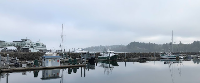
Location: Anacortes, Washington
 |
| Clear sky between the fog banks at the north end of the Grenville Channel |
Tuesday, September 8, 2020 – Ketchikan, Thomas Basin to Lincoln
Channel, Sitklan Island (43 nm, 6 hours):
We made a few phone calls this morning, took up the trash then left the
dock just after 9:00. It was a nice,
sunny day with very little wind and calm seas.
There was a fishery open along the west coast of Peninsula Ridge and
around Cape Fox but most of the boats were close to shore so not many to weave
around. It is a long run from Ketchikan
to Prince Rupert (~80 nm) so we decided to anchor up just north of the border
in Lincoln Channel, between Kanagunut Island and Sitklan Island, and cross the
border tomorrow morning. Just after
sunset, a few fishing boats and a large fishing tender came into the channel to anchor up
for the night.
 |
| Anchorage at Sitklan Island, just north of the Alaska, US / British Columbia, Canada border |
Wednesday, September 9, 2020 – Sitklan Island to North
Kelp Passage via Prince Rupert (52 nm, 7.1 hours): We heaved anchor at 6:00. The fishery was still open this morning and
we had one boat to go around as we exited Lincoln Channel. It was foggy with less than ½ mile visibility
for most of the voyage. At the north end
of Tugwell Island, we announced on the VHF that we would be transiting the Venn Passage east to west. The Venn Passage is a short (~4 nm), winding, shallow water passage around the north side of Digby
Island. If you are traveling from Alaska
to Prince Rupert, it can save as much as 12 miles (~1.5 hours at our normal
cruising speed) compared to going south around Digby Island. As we entered the passage, the visibility
decreased and was less than 1/8 of a mile.
We kept a close lookout for the channel markers and blew our whistle
(fog horn) when we saw targets approaching on the radar that we couldn’t see
through the fog. After exiting the east
side of the narrows, we proceeded to the Customs Dock to clear in to
Canada. Two agents came down to the dock
to take our information and to inform us about the COVID-19 protocol while we
were transiting. We let them know that
we would be anchoring every night but had enough fuel, water and provisions
such that we wouldn’t need to go ashore unless we had an emergency. They took down the list of our tentative
anchorage locations for each night and asked that we call them once we cleared
US Customs so they could close out their file.
After we finished our check in, we got underway and headed south to
North Kelp Passage for the night. We
anchored up and settled in. We won’t be
doing any crabbing, shrimping or fishing on our way through BC so we rinsed our
gear and put it away for the season.
 |
| Dragon cloud over the anchorage at North Kelp Passage |
Thursday, September 10, 2020 – North Kelp Passage to
Coghlan Anchorage (58 nm, 7.2 hours):
Anchor up this morning just after 8:00.
The morning started off clear but we were into the fog with our
navigation lights and radar on within 30 minutes. The fog finally cleared just south of Baker
Inlet.
 |
| A tug and barge appearing out of the fog north of Baker Inlet, Grenville Channel |
The wind picked up and was blowing from the north 25 – 30
knots as we made our way down Grenville Channel, aka “the ditch”. The wind died down as we turned to the southeast
at Morning Reef. We spotted a pod of
whales bubble feeding near Waterman Point so we stopped to watch them for a
while, then turned into Coghlan Anchorage.
There was one sailboat anchored up which was a big change from the last
time we were here when there were 20 – 30 boats in the area. We anchored up about 15:30 and did a few
maintenance chores.
 |
| Sunset Coghlan Anchorage |
Friday, September 11,
2020 – Coghlan Anchorage to Bottleneck Inlet (58 nm, 7.5 hours): We heaved anchor at 7:45 this morning. The winds were light, the seas were calm and
there was no fog so a good day for traveling.
We checked into the southern portion of the Great Northern Boater’s Net
(3870 kHz at 8:00 Pacific Time) for the first time this year. We had been talking to Darlene who runs the
northern portion of the net during the summer but she shut down on September 1st
because there weren’t many boaters up in Alaska this season. We heard lots of reports from Washington,
Oregon and Southern BC about smoke in the air from the forest fires.
 |
| Waterfall along the shore, Fraser Reach |
We stopped to watched some whales bubble feed near Kingcome
Point on the north side of Princess Royal Island. There were a lot of sealions playing along
the shore line and on the buoy in Hiekish Narrows.
 |
| Whales bubble feeding |
 |
| Whales feeding near the shore |
 |
| Sea lions on the buoy in Hiekish Narrows |
We followed another yacht into Bottleneck Inlet and anchored up behind them. The sailboat that was in Coghlan Anchorage last night also
came in and anchored up for the night.
Saturday, September 12, 2020 – Bottleneck Inlet to Wigham
Cove (39 nm, 5.4 hours): Anchor up
at 8:00 this morning. It was overcast
with light winds and calm seas. We saw
two sunfish amongst the islands on the north side of Seaforth Channel as we
came around the corner from Finlayson Channel.
We were anchored up in Wigham Cove by 13:30 and settled in for the
afternoon. It was nice outside so we did
some reading on the stern and did a few boat chores. We watched a flock of ~40 sandhill cranes fly overhead,
going south for the winter.
 |
| Lighthouse at Robb Point in Seaforth Channel |
Sunday, September 13, 2020 – Wigham Cove to Pruth Bay (43
nm, 6 hours): We left the anchorage
at 8:30 this morning.
It was overcast
with light winds and calm seas so we decided to take the outside route down
Raymond Passage and between Goose Island and the McNaughton Group instead of
the inside route.
The voyage was uneventful and we anchored up in Pruth Bay about 14:30. The Hakai Institute is located at the head of Pruth Bay and, in normal years, they allow boaters to come ashore to use the guest wifi and to walk the trails to the various beaches. This year, there were CLOSED signs on the docks and we saw one dinghy get turned away from the docks.
Monday, September 14, 2020 – Pruth Bay to Allison Harbour
(52 nm, 7 hours): This morning we heaved anchor at 7:00 for our journey south around Cape Caution. The weather and currents around Cape Caution can determine whether you have a smooth or a troublesome voyage. Both looked good this morning; the wind and seas were calm and the currents at Slingsby Channel were forecasted to be flooding by the time we got south of the cape. It was foggy as we left the anchorage so we had our radar and our navigational lights on. We made it around the cape with no issues and cruised into Allison Harbour mid-afternoon and anchored up.
 |
| Jellyfish in Allison Harbour |
Tuesday, September 15, 2020 – Allison Harbour: We decided to take a day off today to do some chores and maintenance. The wind was forecast to blow over 20 knots in Queen Charlotte Strait and we didn't want to beat ourselves up. It was nice to take a break.
Wednesday, September 16, 2020 – Allison Harbour to Cullen Harbour (39 nm, 5.2 hours): We left the anchorage at 8:00 this morning and continued our journey south.
 |
| An island near the entrance to Allison Harbour. |
It was foggy with about 1 nm visibility for most of the voyage so we had the lights and radar on. We pulled into Cullen Harbour at 13:00 and anchored up in the northwest lobe. We watched a sailboat come in late afternoon, launch his dinghy and row around the cove putting out his crab pots - we were jealous of him being able to row around and also of the crabs he was likely to catch - as a vessel in transit through BC during the COVID pandemic we were required to stay aboard and to make the most direct route to Washington.
Thursday, September 17, 2020 – Cullen Harbour to Port Neville (39 nm, 5.5 hours): We heaved anchor this morning at 8:30. It was foggy but we could see the sun trying to break through the fog and the smoke. There is a lot of logging activity amongst the islands on the north side of Johnstone Strait and it was a new moon, which means higher high tides and lower low tides, and, because of these two things, there was a lot of flotsam in the water that we had to dodge today. We pulled into Port Neville and were anchored up by 14:00. We had a good cell phone signal so we spent the afternoon catching up on e-mails and the internet.
 |
| The mid-afternoon sun in Port Neville trying to break through the fog and the smoke from the fires further south. |
Friday, September 18, 2020 – Port Neville to Maud Island (44 nm, 5.4 hours):
Today was our day to transit
Seymour Narrows, a narrow section of Discovery Passage and the main channel used by cruise ships, fishing boats and tugs and barges transitting the inside passage. Currents through the narrows can run as much as 15 knots and with the new moon, today they were running 13 knots. Ripple Rock used to be in the center of the narrows, but they blew it up in 1958 to make it safer for ships to go through. There are a lot of good You Tube videos about the Ripple Rock explosion;
this is the link to one of them. In order to arrive near slack water we calculated that we should depart our anchorage at Port Neville at 13:00. We spent the morning on the internet and doing administrative chores. If you remember the pictures of the crawfish like creatures from the previous blog, we finally learned that they are
Munida Quadrispina, a squat lobster. In Alaska they call them "krimp". You can eat them but they don't have much meat.
Anchor up at 12:45 and we got underway. We had the current pushing us the entire way and our speed over ground got up to over 13 knots with a 6 knot current pushing us through Race Passage and again through Ripple Shoal near Camp Point. Along with the speed there were a lot of whirlpools with logs and other flotsam getting swirled around with us. Because the current was with us, we were on track to arrive at Seymour Narrows at 17:00 when the current there would still be running over 9 knots.
As we cruise, we like to listen to the VHF radio and the conversations between "Traffic" (
Vessel Traffic Services (VTS)) and various vessels. There is a VTS check point just north of Seymour Narrows and another on the south side. As vessels reported in, Traffic would ask them what time they planned to transit the narrows. They would reply and then Traffic would say something like "the current at that time will be running 9 knots, do you feel comfortable transiting at that speed?". More times than not, the vessel would respond and say that they would slow down and wait to transit the narrows after the current decreased and it was closer to slack water. We are too small to need to talk to Traffic but we heeded the warnings they gave others and pulled into Elk Bay to wait before proceeding to the narrows.
Dall Porpoises riding our bow wake just north of Seymour Narrows
After an hour of drifting, we fired the engine back up and continued south down Discovery Passage. Just north of the narrows, we had a small pod of Dall's porpoises come out and cruise our bow wake. This is the first pod we've seen this year and we enjoyed watching them. We got to the narrows about 15 minutes before slack water with the current running less than 2 knots and went through with no issues. We made our way around the south side of Maud Island and anchored up in front of a small causeway that connects Maud Island to Quadra Island. Seymour Narrows is on the other side of the causeway and we watched an Alaskan State Ferry and a tug and barge make their way through going south.
 |
| The north shore in the Maud Island anchorage. The figure under the tree is a man made out of logs. |
 |
| The Alaskan State Ferry Kennicott transitting Seymour Narrows. |
Saturday, September 19, 2020 – Maud Island to Tucker Bay, Lasqueti Island (58 nm, 8.5 hours): The anchorage was very quiet although we could hear the roar of Seymour Narrows on the other side of the causeway. Anchor up at 6:45 this morning to catch the last of the flood in Discovery Passage and the ebb down the Strait of Georgia. The currents on the inside of Vancouver Island (the east side) flood and ebb from both the north and south and meet between Shelter Point and Kuhushan Point (between Campbell River and Comox). We should have left about 45 minutes earlier as the ebb current was already flowing north before we got to Cape Mudge and our speed over ground got as low as 4.0 knots.
 |
| The Cape Mudge Lighthouse |
We got back up to our normal cruising speed once we got out into Sutil Channel. It was good traveling weather, overcast but not foggy, with light winds and calm seas. Mid-afternoon we anchored up in Tucker Bay on the north side of Lasqueti Island. While we were sitting in the pilot house listening to Traffic, we saw a skiff in the cove next to us having problems starting their outboard. We watched for a while then launched the dinghy and gave them a tow back to their cabin on the island.
Sunday, September 20, 2020 – Tucker Bay to Clam Bay (41 nm, 5.8 hours): We left the anchorage at 8:00 this morning to time our arrival for slack water at Dodd Narrows which is just south of Nanaimo. Currents in Dodd Narrows can run as high as 9 knots, today max was 8.0 knots, so it is best to transit near slack water. As we left the Strait of Georgia and entered Fairway Channel, we saw a group of sailboats out racing and enjoying the nice weather. We got to the north entrance of Dodd Narrows about 45 minutes prior to slack. The current was running ~2.5 knots with us and we decided it was ok to go through. The narrows is only about 600 feet long with cabins on both sides and people were sitting along both sides of the shore watching boats go through. We waved as we went by. Our anchorage for the night was in Clam Bay near the north shore of Penelakut Island.
 |
| Sunrise at Clam Bay |
Monday, September 21, 2020 – Clam Bay to Roche Harbor (31 nm, 4.4 hours): Today was our last day cruising/transiting British Columbia. We heaved anchor at 9:00 and headed toward the Canada / USA border.
 |
| A barge loaded with logs in Captain Passage.between Salt Spring and Prevost Islands. |
We crossed the border at 12:00 and took down our Canadian Flag. We called US Customs and Border Patrol to check in but were told we would need to go to the customs dock in Roche Harbor. We could hear a lot of boats calling Roche Harbor on the VHF and asking for slip assignments so we gave them a call to make sure they had space available. They said they had plenty of slips and that we could stop in at the office to get a slip assignment after we cleared Customs.
 |
| Approaching Roche Harbor |
We cleared Customs with no issues and pulled into our slip at the transient dock. It was a beautiful day and we took an afternoon walk to the
Sculpture Park then had a gourmet supper at McMillian's.
 |
| B with Large Marge and her two cubs in the Sculpture Park. |
Tuesday, September 22, 2020 – Roche Harbor, WA: Roche Harbor is a resort with a large marina, several restaurants, a hotel, a spa, cabins, a swimming pool, a grocery store, etc. Although it is late in the summer season and there is a COVID pandemic, Roche Harbor seemed very busy. People were wearing masks and social distancing but other than that operations felt normal. We spent the morning doing chores then had lunch at the cafe. For our afternoon walk we went back to the Sculpture Park to pick black berries. There was a sign near the entrance that said pick all the black berries and mint that you want so we took two plastic containers and filled them up.
 |
| Dave picking black berries at the Sculpture Park |
 |
| Our black berries washed and ready to eat. |
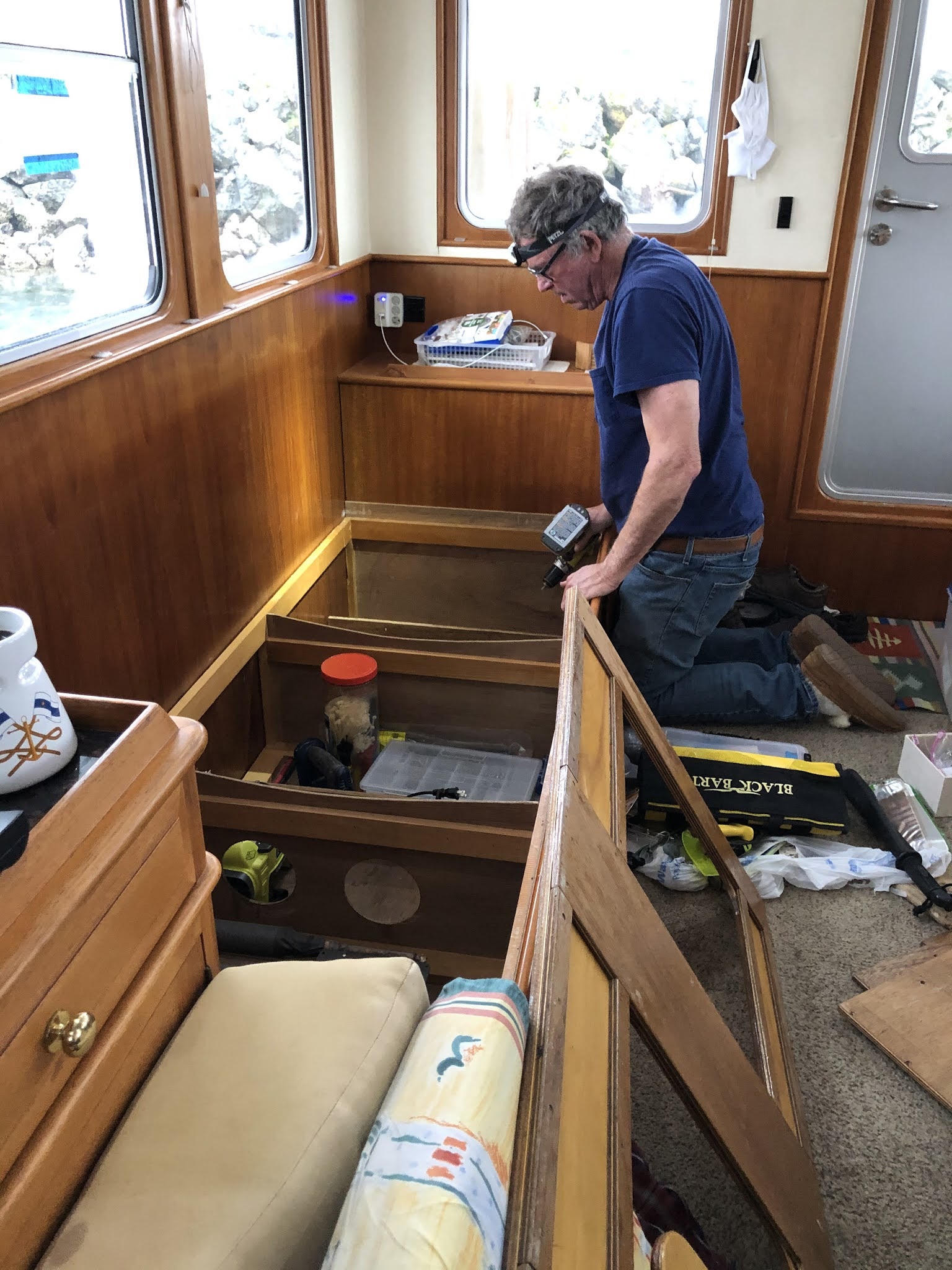
Wednesday, September 23, 2020 - Roche Harbor: The wind picked up over night and it rained most of the day today. We spent the morning doing boat chores and walked the docks during a break in the rain after lunch.
Thursday, September 24, 2020 - Roche Harbor to Cap Sante Marina, Anacortes (28 nm, 4 hours): We left Roche Harbor in the rain this morning and cruised east through the San Juan Islands to Anacortes. We'll stay here one night, do a few chores and get a few groceries and then move to La Conner tomorrow.
Until Next Time…


