Location: Brookings, Oregon
According to the locals, "Faugust" is the month between July and September and the "Lost Coast" is defined by Wikipedia as the "
a mostly natural and development-free area of the the California Coast between Humboldt and Mendocino Counties." https://en.wikipedia.org/wiki/Lost_Coast
After patiently waiting for 3 weeks; we finally got a good weather window and departed the San Francisco Bay Area on Tuesday, July 19th and most of our cruising since then has been in the fog.
 |
| Point Bonita Lighthouse, just outside the Golden Gate Bridge |
 |
| Golden Gate Bridge as we were leaving the SF Bay |
Our first stop was Bodega Bay (51 miles, 8 hours). We saw a few whales along the way. We tied up at the Spud Point Marina, checked in and then walked into town.
http://parks.sonomacounty.ca.gov/Get_Outdoors/Spud_Point_Marina.aspx
The movie "The Birds" was filmed in Bodega Bay so we stopped at "The Birds" Cafe for a beer and then had supper at a small restaurant across the street. The next afternoon, I went for a walk out to Bodega Head where there is a good overlook of the jetties protecting the harbor, Bodega Bay's "Hole in the Head" and the Pacific Ocean. The "Hole in the Head" was a project by PG&E in the early 1960s to build a nuclear reactor out on Bodega Head. Locals protested because the San Andreas Fault line runs through the area. Eventually, the 1964 earthquake in Alaska put a stop to the construction as part of the land surrounding the project site shifted. You can read more about the project and the protests at
http://www.sonomawest.com/sonoma_west_times_and_news/news/revisiting-the-history-of-bodega-bay-s-hole-in-the/article_3cdd5880-6aa8-11e4-bafd-af05a4d1c882.html
 |
| The Birds Cafe, Bodega Bay |
 |
A lone, windswept tree on Bodega Head, looking west
towards the Pacific Ocean. |
 |
| Picture of Bodega Bay's "Hole in the Head" |
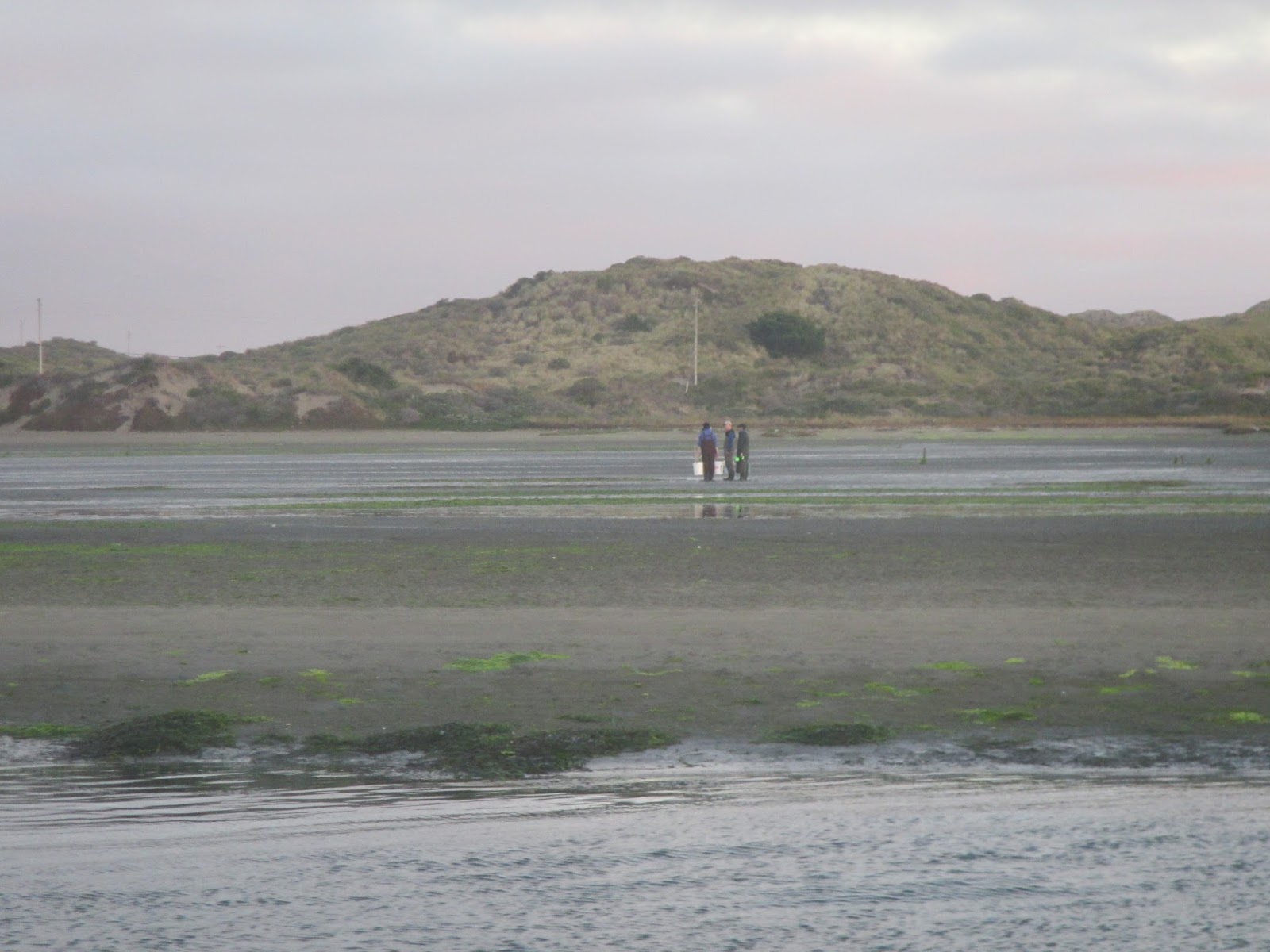
We left Bodega Bay early morning on Thursday, July 21 for the voyage north to Fort Bragg (87 miles, 12.3 hours).
 |
| Clam diggers taking advantage of the low tide as we were leaving Bodega Bay. |
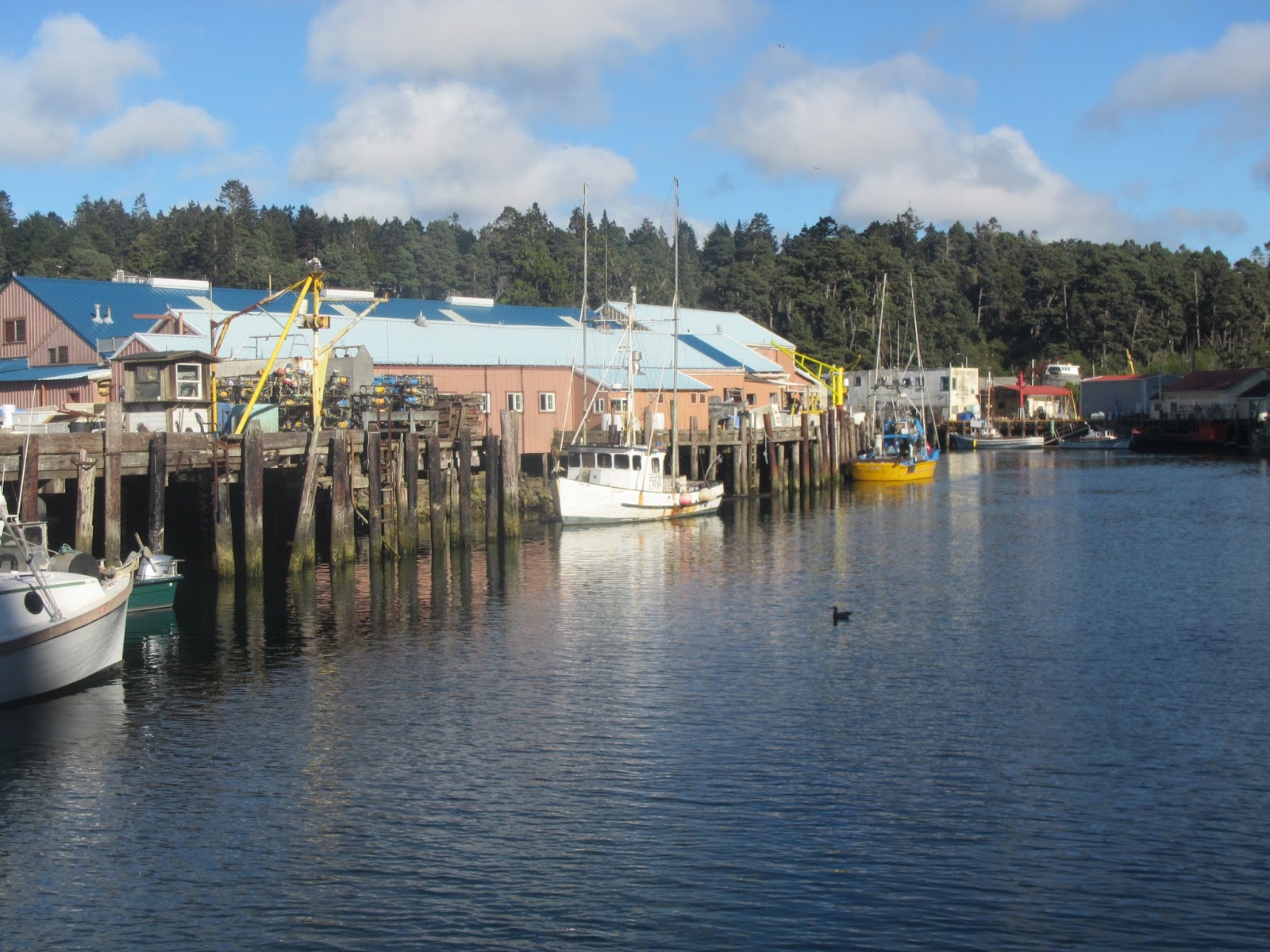
We cruised into the Noyo River entrance early evening. Fort Bragg is a small fishing town and the Noyo Harbor is home to the local fishing fleet.
 |
| North side of the Noyo River as we were cruising into the harbor. |
 |
| View of the Noyo Harbor from our stern. |
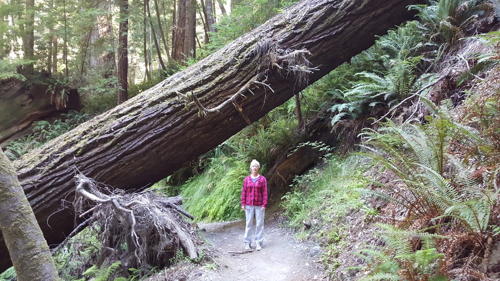
For a change of scenery, we rented a car and drove up to Redwood National and State Parks. The size of the trees and the scenery is amazing. We drove some of the back roads that take you through old growth groves, hiked down into a river valley and through the Tall Trees grove, where the world's tallest tree used to live. The top fell off of it some time ago and today is ranks as the 34th tallest. We also did some hiking along the beach cliffs to an old WWII radar station camouflaged as a farm,
https://www.nps.gov/nr/travel/aviation/rad.htm and up to a fern canyon, where they filmed part of Jurassic Park II.
 |
| Roosevelt Elk near Orick, CA |
 |
| World War II Klamath River Radar Station B-71. |
 |
| Giant redwoods in Jedidiah Smith State Park |
 |
| B on the trail |
 |
| Tall Trees Grove |
 |
| Fern Canyon |
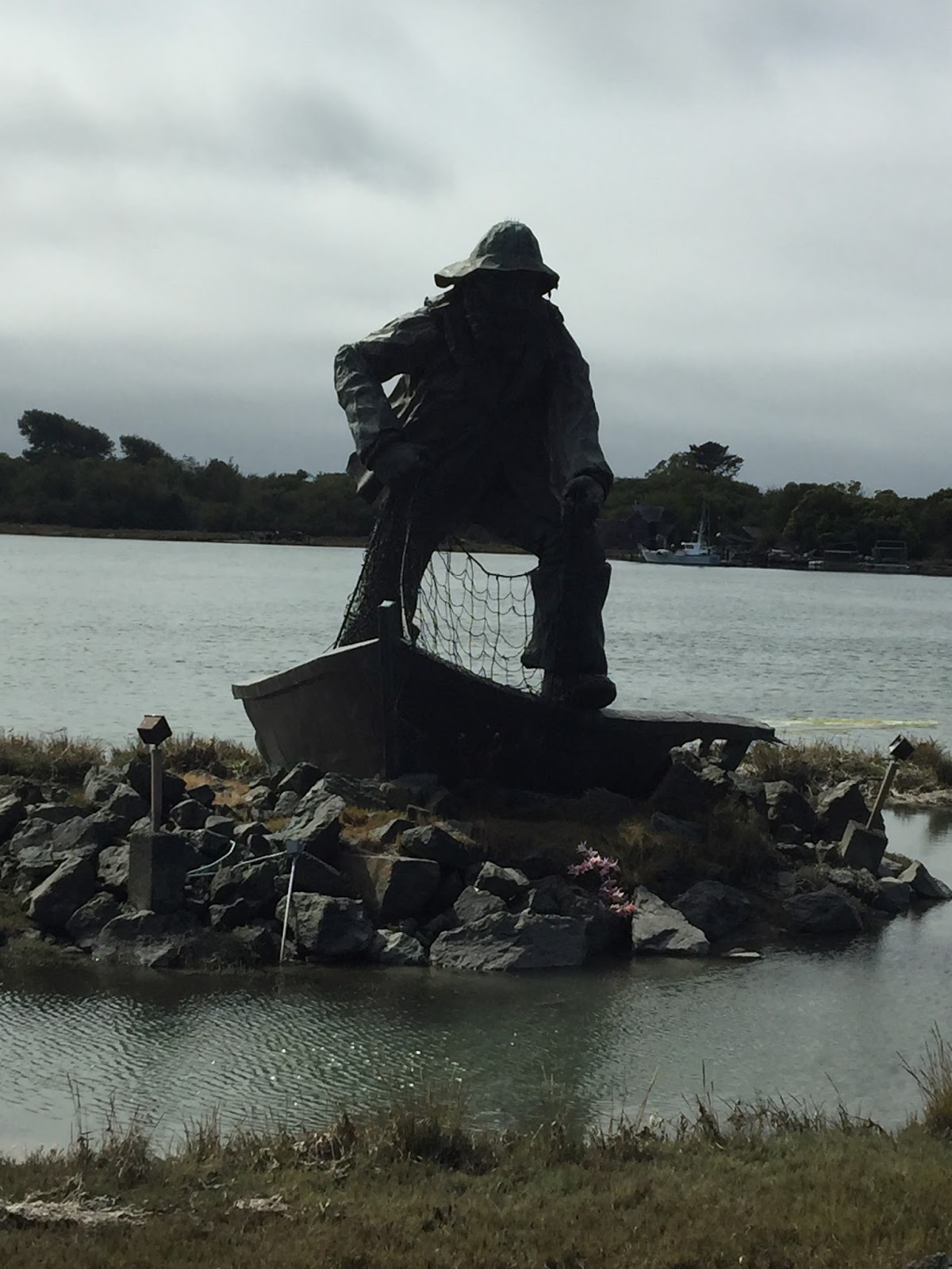
We finally got a weather window to continue our journey and left Fort Bragg early morning Sunday, August 7th. We arrived in Eureka (103 miles, 14.6 hours) on the flood tide, tied up at the Woodley Island Marina and walked up to the marina cafe for supper. Eureka is an historic town with a lot of victorian style mansions and buildings. Tuesday we walked into town to do some exploring and to have lunch at Nooner's cafe which has been featured on Diners, Drive-Ins and Dives
http://www.dinersdriveinsdiveslocations.com/cafe-nooner-california.html
 |
| Splash from a humpback whale breaching. |
 |
| Fisherman's memorial, Woodley Island, Eureka, CA |
 |
| Victorian style mansion near downtown Eureka |
 |
| Lunch at Nooner's Cafe |
 |
| Theater building, Eureka, CA |
 |
| Mural on the back of the theater building |
 |
| Mural on the alley side of the theater building |
We left Eureka and cruised to Crescent City (65 miles, 9.2 hours) on Friday, August 12th. We checked into the Crescent City Harbor marina and then walked to a local seafood restaurant for supper. Saturday we visited Ocean World, a privately owned aquarium
http://oceanworldonline.com/
We bought some groceries and had supper at a local mexican restaurant.
 |
| Rock that looks like Godzilla's head outside the entrance to Crescent City Harbor. |
 |
| Float full of sealions, Crescent City Harbor. |
 |
| We were allowed to "pet" this leopard shark and swell shark at OceanWorld. |
 |
| Cora Sealion at OceanWorld. |
Sunday morning we traveled to our first stop in Oregon, Brookings (23 miles, 3.3 hours). We arrived late morning, tied up to the guest dock and went to Pirate Fest at the harbor boardwalk. Our plan is to stay here until Saturday when we should have a four day weather window to continue our journey north.
 |
| Pirate Fest, Brookings, Oregon |
 |
| The beach on the south side of the entrance jetties, Brookings, OR. |
 |
| Chetco River, Brookings, OR |
 |
| Blackberries are in season. |